Ajdabiya
| Ajdabiya أجدابيا Agedabia | |
|---|---|
| Town | |
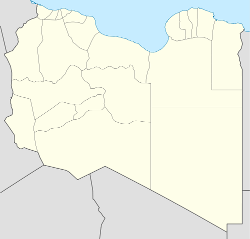 Ajdabiya Location in Libya | |
| Coordinates: 30°45′20″N 20°13′31″E / 30.75556°N 20.22528°ECoordinates: 30°45′20″N 20°13′31″E / 30.75556°N 20.22528°E | |
| Country |
|
| Region | Cyrenaica |
| District | Al Wahat |
| Elevation[1] | 7 ft (2 m) |
| Population (2010)[2] | |
| • Total | 76,968 |
| Time zone | EET (UTC+2) |
Ajdabiya /ˌɑːdʒdəˈbiːə/ (Arabic: أجدابيا Ağdābiyā, Italian: Agedábia), previously known as Agedabia or Ajdabya,[3][4] is a town in and capital of the Al Wahat District in northeastern Libya. It is some 150 kilometres (93 mi) south of Benghazi. From 2001 to 2007 it was part of and capital of the Ajdabiya District. The town is divided into three Basic People's Congresses: North Ajdabiya, West Ajdabiya and East Ajdabiya.[5]
During the Libyan Civil War, the city changed hands several times between rebels and pro-Gaddafi forces. Many civilians fled from the fighting, with one March 2011 report describing the city as a "ghost town."[6] Libyan rebels appeared to have regained control indefinitely in late March after international airstrikes crippled Muammar Gaddafi's forces, in the first major turnaround for an uprising that a week earlier appeared on the verge of defeat.[7]
Geography
Ajdabiya is situated in central northern Libya near the Mediterranean Sea coast at the eastern end of the Gulf of Sidra. It is located on an arid plain about 6.4 kilometres (4.0 mi) from the sea and is approximately 850 kilometres (530 mi) from the Libyan capital of Tripoli and 150 kilometres (93 mi) from Libya's second largest city, Benghazi. The city is the site of an important crossroads between the coastal road from Tripoli to Benghazi and inland routes south to the oasis at Jalu and east to Tobruk and the border with Egypt.[8] Ajdabiya lies close to the Sabkhat Ghuzayyil a large dry region below sea level.
Climate
| Climate data for Ajdabiya | |||||||||||||
|---|---|---|---|---|---|---|---|---|---|---|---|---|---|
| Month | Jan | Feb | Mar | Apr | May | Jun | Jul | Aug | Sep | Oct | Nov | Dec | Year |
| Record high °C (°F) | 27.5 (81.5) |
36.7 (98.1) |
39.0 (102.2) |
47.2 (117) |
47.4 (117.3) |
46.7 (116.1) |
46.0 (114.8) |
45.6 (114.1) |
45.2 (113.4) |
40.3 (104.5) |
35.6 (96.1) |
30.6 (87.1) |
47.4 (117.3) |
| Average high °C (°F) | 17.6 (63.7) |
19.3 (66.7) |
22.0 (71.6) |
26.2 (79.2) |
30.3 (86.5) |
33.3 (91.9) |
32.1 (89.8) |
32.8 (91) |
32.0 (89.6) |
29.0 (84.2) |
24.0 (75.2) |
19.2 (66.6) |
26.5 (79.7) |
| Daily mean °C (°F) | 12.5 (54.5) |
13.7 (56.7) |
16.0 (60.8) |
19.7 (67.5) |
23.3 (73.9) |
26.1 (79) |
25.8 (78.4) |
26.3 (79.3) |
25.3 (77.5) |
22.5 (72.5) |
18.1 (64.6) |
14.1 (57.4) |
20.3 (68.5) |
| Average low °C (°F) | 7.5 (45.5) |
8.0 (46.4) |
10.0 (50) |
13.2 (55.8) |
16.4 (61.5) |
19.0 (66.2) |
19.5 (67.1) |
19.8 (67.6) |
18.7 (65.7) |
16.1 (61) |
12.1 (53.8) |
8.9 (48) |
14.1 (57.4) |
| Record low °C (°F) | 0.4 (32.7) |
0.2 (32.4) |
1.8 (35.2) |
3.9 (39) |
7.2 (45) |
9.4 (48.9) |
11.2 (52.2) |
10.0 (50) |
9.2 (48.6) |
7.0 (44.6) |
3.6 (38.5) |
1.9 (35.4) |
0.2 (32.4) |
| Average precipitation mm (inches) | 40 (1.57) |
23 (0.91) |
6 (0.24) |
1 (0.04) |
2 (0.08) |
0 (0) |
0 (0) |
0 (0) |
0 (0) |
8 (0.31) |
22 (0.87) |
27 (1.06) |
129 (5.08) |
| Average precipitation days (≥ 0.1 mm) | 9 | 4 | 4 | 2 | 1 | 0 | 0 | 0 | 1 | 2 | 4 | 8 | 35 |
| Average relative humidity (%) | 68 | 65 | 54 | 47 | 43 | 47 | 54 | 52 | 52 | 52 | 57 | 66 | 55 |
| Mean monthly sunshine hours | 206 | 216 | 250 | 267 | 312 | 344 | 377 | 360 | 301 | 273 | 230 | 191 | 3,327 |
| Source: Deutscher Wetterdienst (sun 1961–1990)[9][10][lower-alpha 1] | |||||||||||||
History
Ajdabiya has been identified as the site of the Roman city of Corniclanum, which is shown on the Peutinger Table of the Roman road network in the fourth or fifth centuries AD.[11] It gained its importance for two reasons: it possessed drinkable water, which made it a useful staging post in an arid region, and it stood on the intersection of two important trade routes, the coastal route along the North African littoral and the desert caravan route from the oases of Jalu and al-Ujlah.[8] The town passed to the Byzantine Empire following the fall of Rome but gained new importance under the rule of the Fatimid Caliphate. After sacking the town in 912, the Fatimids redeveloped Ajdabiya and built a new mosque and palace complex, the ruins of which can still be seen.[12] Around 1051–52 it was sacked again, this time by the Beni Hilal and Banu Sulaym, Arab tribes that migrated to North Africa at the instigation of the Fatimids. It subsequently fell into a prolonged period of decline.[8]
In the 12th century, the Arab geographer Muhammad al-Idrisi described Ajdabiya as "a town situated on a flat, stony plateau". He wrote in his treatise Nuzhat al-Mushtaq (published in Europe as De geographia universali):
- In olden times [Ajdabiya] was surrounded by walls, but now only two forts remain standing in the desert. Ajdabiya is four miles distant from the sea. There is no vegetation in the town nor around it. The majority of its inhabitants are Jewish and Muslim merchants. Around the town tribes of the Berber wander about in great numbers. There is no running water either in Ajdabiya or in Barqa, and the people get their water from cisterns and water-pits (sawani), [which they use] to grow a small amount of wheat, but mainly barley and various kinds of pulses and cereals.[13]

The town was later revived by the Ottomans to serve as a minor administrative centre for western Cyrenaica. It became an important centre for the Senussi movement in the early 20th century and became the capital of an autonomous Senussi-ruled region between 1920 and 1923 under the terms of an accord with Italy, which had occupied Libya from 1911. In April 1923, however, the accord broke down and the Italians seized Ajdabiya, turning it into an important military outpost.[8] The area was the scene of heavy fighting during the Second World War; during Operation Compass in December 1941, British forces forced Erwin Rommel's Afrika Korps to retreat through Ajdabiya, but they lost control of it again on April 2, 1942 when a reinforced Rommel counter-attacked.[14] The town finally reverted to Allied control on November 23, 1942 when it was recaptured by the British 7th Armoured Division.[15]
Ajdabiya's fortunes were transformed after the war by the development of the Libyan oil industry at nearby Brega. By 1979 it had become a boom town with a population of about 32,000 people. The bulk of the male population worked in the oil industry, government service or other local service industries. The town acquired a new area of public housing, police stations, educational facilities and a general hospital run by Libya's ally Bulgaria. In other respects, however, it remained comparatively undeveloped – many of the roads were left as dirt tracks without drainage, resulting in them being muddy and flooded in the winter and dirty and dusty in the summer. Libya's predominately tribal society also resulted in an unusual style of urbanisation; nomadic members of the Zuwaya tribe settled on the outskirts of the town and established tent camps, which they gradually replaced with houses. The layout of some areas of the town thus resembles that of nomadic camps, with a senior man in the centre of an area, his married sons nearby, with their younger brothers and their own sons clustered around them.[16]
Libyan civil war
Ajdabiya was the site of anti-government protests on February 16–17, 2011 in which up to ten people were said to have been killed, some by pro-government snipers.[17] Protesters quickly took control of the city and declared it to be a "Free City" after burning down the local government headquarters.[18] The city subsequently came under attack from the Libyan air force and on March 15, 2011 the Libyan army encircled Ajdabiya in preparation for an assault to retake it.[19] The battle for Ajdabiya was cited as a potential turning point in the conflict on which the fate of the whole rebellion against the Gaddafi government could be decided.[20] After two days of heavy fighting, pro-Gaddafi forces seized the strategic crossroads, gained control of most of the city and pressed on to the rebel-held stronghold of Benghazi.
The city was retaken by rebel forces on March 26, 2011 after air strikes authorised by the United Nations destroyed much of the Libyan army's heavy weaponry in and around Ajdabiya and forced them to retreat to the west.[21] Much of the population fled the fighting in the city, which was reported to have suffered heavy damage.[22]
On April 8, loyalist forces attempted to recapture the city. Taking advantage of a disorganised rebel retreat following the Third Battle of Brega, loyalist troops entered the city and had taken control of most of it by April 9.[23] However, rebel forces soon regrouped and had pushed pro-Gaddafi forces out of the city by April 11, with heavy support from NATO airstrikes.[24][25] The front line then stagnated outside of the city, 40 km down the road to Brega.[26] Loyalist shells continued to intermittently strike the western gate and outskirts of the city for several days.[27] In April 2011, the citizens of Ajdabiya decided to rename the city's principal square as "Tim Hetherington Square", in honour of the British photojournalist killed in Misrata.[28]
Transport
- A station on the proposed Libyan railway network may be located here. The interstate line through Tobruk may diverge here from the coastal line to Benghazi to avoid difficult coast terrain and to save distance.[29]
- Ajdabiya is on the crossroads of many important roads in Libya:
See also
| Wikimedia Commons has media related to Ajdabiya. |
Notes
- ↑ Station ID for Agedabia is 62055 Use this station ID to locate the sunshine duration
References
- ↑ Wolfram Alpha Archived May 12, 2014, at the Wayback Machine.
- ↑ "Libya: largest cities and towns and statistics of their population". Archived from the original on May 23, 2012.
- ↑ B. H. Liddell Hart, 1970, History of the Second World War, pp. 206, 278
- ↑ Goodchild, R. G. (1951) "Boreum of Cyrenaica" The Journal of Roman Studies 41(1/2): pp. 11–16, page 16
- ↑ "شعبيات الجماهيرية العظمى " Sha'biyat of Great Jamahiriya, accessed July 6, 2007 Archived February 7, 2009, at the Wayback Machine.
- ↑ Elisbeth Bumiller and David Kirkpatrick Allies Pressure Qaddafi Forces Around Rebel Cities The New York Times March 23, 2011
- ↑ Hubbard, Ben; Lucas, Ryan. "Air Raids Force Gadhafi Retreat, Rebels Seize East" The Associated Press, March 26, 2011
- 1 2 3 4 Azema, James (2000). Libya Handbook The Travel Guide. Footprint Handbooks. pp. 136–137. ISBN 978-1-900949-77-4.
- ↑ "Klimatafel von Agedabia / Libyen" (PDF). Baseline climate means (1961-1990) from stations all over the world (in German). Deutscher Wetterdienst. Retrieved 27 March 2016.
- ↑ "Station 62055 Agedabia". Global station data 1961–1990—Sunshine Duration. Deutscher Wetterdienst. Retrieved 27 March 2016.
- ↑ al-ʻĀmmah lil-Āthār wa-al-Matāḥif wa-al-Maḥfūẓāt, Idārah. Libya antiqua, Volumes 8–10, p. xlii. Libyan Department of Antiquities, 1971
- ↑ Petersen, Andrew (1999). Dictionary of Islamic Architecture. Psychology Press. pp. 8–9. ISBN 978-0-415-21332-5.
- ↑ Hopkins, J.F.P.; Levtzion, Nehemia (2000). Corpus of Early Arabic Sources for West African History. Markus Wiener Publishing. p. 129. ISBN 978-1-55876-241-1.
- ↑ Greene, Jack; Massignani, Alessandro (1999). Rommel's North Africa Campaign September 1940 – November 1942. Da Capo Press. p. 55. ISBN 978-1-58097-018-1.
- ↑ "Defeat Of The Wehrmacht II – How Alamein Was Planned And Won, The Army Commander's Vital Decisions". The Times, February 18, 1947; p. 5
- ↑ Davis, John (1988). Libyan Politics Tribe and Revolution an Account of the Zuwaya and Their Government. University of California Press. pp. 82–84. ISBN 978-0-520-06294-8.
- ↑ Black, Ian. "Libya's day of rage met by bullets and loyalists". The Guardian, February 17, 2011 Archived November 30, 2012, at the Wayback Machine.
- ↑ Spencer, Richard; Ramdani, Nabila. "Middle East crisis: Libyan protests move closer to Tripoli". The Daily Telegraph, February 20, 2011. Archived December 11, 2011, at the Wayback Machine.
- ↑ Crilly, Rob. "Libya: rebels flee stronghold of Ajdabiya as Gaddafi closes net". The Daily Telegraph, March 15, 2011. Archived January 22, 2013, at the Wayback Machine.
- ↑ Dehghanpisheh, Babak. "The Libyan Rebels' Decisive Next Battle". March 14, 2011. Archived July 23, 2012, at WebCite
- ↑ "Libya revolt: Rebels grab Ajdabiya from Gaddafi". BBC News, March 26, 2011 Archived September 5, 2011, at the Wayback Machine.
- ↑ Fahim, Kareem; Kirkpatrick, David D. "Airstrikes Clear Way for Libyan Rebels’ First Major Advance". The New York Times, March 26, 2011
- ↑ Chivers, C. J. (April 9, 2011). "Qaddafi Forces Press Rebels With Attack on a Key City". The New York Times. Archived from the original on June 18, 2013. Retrieved April 9, 2011.
- ↑ "Libya Live Blog – April 11". April 11, 2011. Archived from the original on April 30, 2012. Retrieved April 11, 2011.
- ↑ Chivers, C. J. (April 10, 2011). "Rebels and NATO Strikes Repel Assault on Key Libyan Town". The New York Times. Archived from the original on June 18, 2013. Retrieved April 10, 2011.
- ↑ Croft, Adrian; Golovnina, Maria (April 13, 2011). "Western Arab nations say Gaddafi must go". The Star. Toronto. Archived from the original on October 24, 2012. Retrieved April 13, 2011.
- ↑ "Gaddafi's forces bombard east Libya town outskirts". Reuters Africa. Reuters. April 12, 2011. Archived from the original on September 11, 2012. Retrieved April 12, 2011.
- ↑ "Ajdabiya honours fallen British photojournalist". April 22, 2011. Archived from the original on September 2, 2011. Retrieved April 29, 2011.
- ↑ Bringinshaw, David. "Libya's First Two Railway Lines Start To Take Shape. International Railway Journal, January 2001.
External links
- "Ajdabiya, Libya", Falling Rain Genomics, Inc.
- "Ajdabiya Map — Satellite Images of Ajdabiya" Maplandia.com
- Search for Ajdabiya in the MSN Encarta atlas
| Capital | ||
|---|---|---|
| Towns and villages | ||
| Capital | ||
|---|---|---|
| Towns and villages | ||