Airlines PNG Flight 4684
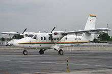 A De Havilland Canada DHC-6-300 Twin Otter, similar type of the crashed plane | |
| Incident summary | |
|---|---|
| Date | 11 August 2009 |
| Summary | Controlled flight into terrain due to pilot error |
| Site |
Isurava, Papua New Guinea 8°53′S 147°44′E / 8.883°S 147.733°ECoordinates: 8°53′S 147°44′E / 8.883°S 147.733°E |
| Passengers | 11 |
| Crew | 2 |
| Fatalities | 13 (all) |
| Survivors | 0 |
| Aircraft type | Twin Otter |
| Operator | Airlines PNG |
| Registration | P2-MCB |
| Flight origin | Jacksons International Airport, Port Moresby, Papua New Guinea |
| Destination | Kokoda Airport, Oro Province, Papua New Guinea |
Airlines PNG Flight 4684 (CG4682/TOK4684) was a scheduled domestic passenger flight, operated by Papua New Guinean airliner Airlines PNG, flying from Jacksons International Airport in Papua New Guinea’s capital Port Moresby to Kokoda Airport in Oro Province, Papua New Guinea. On 11 August 2009, the aircraft operating the flight, a de Havilland Canada Twin Otter, crashed and exploded into a forest in Kokoda Valley, a popular trekking site in Papua New Guinea while carrying 13 people in bad weather. A search and rescue operation was conducted by authorities and found the wreckage of the crashed plane on the next day, 12 August 2009. The aircraft was pulverized, and searchers didn’t find any signs of life. Papua New Guinean Search and Rescue Agency then announced that everyone on board were killed instantly in the crash.[1]
The Australian Transport Safety Bureau were involved in the investigation to the cause of the crash and released its final report, concluding that the plane was crashed due to pilot error. The plane deviated from its original flight path and the visual reference in Kokoda Gap was obscured by clouds, causing the pilots to not aware of their proximity with the ground. The ATSB classified the accident as controlled flight into terrain.[2]
Flight

The aircraft departed Jacksons International Airport at 10:50 am local time and reported to Jacksons Tower that they were climbing for 9.000 ft to Kokoda via the Kokoda Gap, with an estimated time of arrival at 11:20 am. At 11:11 am, while en route to Kokoda and on descent in Kokoda Gap, the crew of Flight 4684 conversed with the crew of an aircraft, registered P2-KST (KST), which was departing from Kokoda. There was not a single indication that the crews of Flight 4684 had any problem with their aircraft. The crew tried to land at its first attempt, but failed. The aircraft later contacted Kokoda Tower and began its go-around. Inside the ATC recording, the crew was heard saying “Thank you very much, morning long you”. This was the last communication of Flight 4684.[3]
Witnesses at Isurava village stated that they observed an aircraft fly low over the village at about the estimated time of the accident. Witnesses at the nearby Misima village stated that they heard an aircraft fly near their village but that they could not see the aircraft, as the area was covered by cloud. They reported that shortly after, there was a loud bang above their village and the sound of the aircraft stopped. Port Moresby ATC then lost contact with Flight 4684.[4][5]
Port Moresby ATC then desperately tried to contact Flight 4684, even requesting nearby aircraft in the area to contact the plane. However, there were no response from Flight 4684. They then asked to P2-MCD, an Airlines PNG plane departing from Efogi, if Flight 4684 had landed in Kokoda. The crews of P2-MCD then stated that P2-MCD did not land in Kokoda. Port Moresby ATC then declared Flight 4684 status to ALERFA, and then subsequently to DISTRESFA.[6]
Search and rescue team scoured the area where Flight 4684 had lost contact. But the search and rescue operation was hampered by bad weather, low visibility and rough terrain. On 12 August 2009, a search and rescue team Dornier plane detected an ELT signal in the search area. Later on, a search and rescue team found the wreckage of Flight 4684. The aircraft was totally destroyed. The search team did not detect any signs of life in the crash site, and announced that no one survived the crash.[7][8]
Aircraft
The aircraft involved in the accident was a De Havilland Canada Twin Otter, registered in Papua New Guinea as P2-MCB. It has a serial number of PCE-PG0073. The aircraft was configured to carry 19 passengers and two crew, and had a maximum take-off weight of 5.670 kg. The aircraft was fitted with the required equipment for two-pilot IFR flight, however autopilot system was not fitted in the aircraft. As for August 2011, the aircraft had accumulated a total flying hours of 46.700 hours.[9](p9–10)
Passengers
The plane was carrying 11 passengers and 2 crews on board. The passengers included nine Australian tourists on their way to trek the Kokoda Track, two tour guides (one Australian and one Papua New Guinean) from No Roads Expeditions tour company, and a Japanese tourist. Seven of the nine Australian passengers on board came from Victoria, and two from Queensland.[10] Notable passenger aboard the flight was the part-time tour guide of the flight Matthew Leonard,[11] which was the son of West Australia police inspector Bill Leonard.[12][13]
| Nationality | Passengers | Crew | Total |
|---|---|---|---|
| | 9 | 0 | 9 |
| | 1 | 2 | 3 |
| | 1 | 0 | 1 |
| Total | 11 | 2 | 13 |
The Captain was Jannie Moala from Papua New Guinea. She had accumulated a total flying hours of 2.177 hours in which 1.836 of them were on the Twin Otter. ATSB did find any evidence that she had been trained by Airlines PNG for Global Positioning System (GPS). However, training records that were provided by the operator showed that items identified within the operator’s training syllabus that included the introduction to, and use of the GPS for en route navigation had been ‘ticked’ by the training captain as complete. No evidence as to the extent of that training, or level of understanding attained by Captain Jannie was provided by the operator. The operator stated that at about the time of the accident, a GPS training package specific to the conduct of GPS non-precision approaches was being ‘rolled out’.[14](p5–6)[15]
The co-pilot was First Officer Rodney Souka from Papua New Guinea. He had accumulated a total flying hours of 2.150 hours in which 1.940 of them were on the Twin Otter. ATSB did not find any evidence that First Officer Rodney had been trained by Airlines PNG for Global Positioning System (GPS) of the aircraft.[16](p7–8)[17]
Investigation
The Australian Transport Safety Bureau (ATSB) were requested by Papua New Guinean Government in assisting the crash investigation. However, the ATSB could only determine the cause of the crash without the FDR and the CVR, as both flight recorders were not mandatory to be equipped on a Twin Otter, based on aviation regulations. The lack of both flight data and cockpit voice recorders adversely affected a full understanding of the accident by the investigation.[18](p9–10)

The weather in Kokoda Gap at the time was in bad condition. Based on eyewitnesses accounts and photographic evidence retrieved by ATSB, at the time of the accident, Kokoda Gap was obscured by clouds, making it difficult for the pilots to know if they were in close proximity with the ground. Given the surrounding mountainous terrain, the evident cloud in the Kokoda Gap, as in this instance, had the potential to severely limit the crew’s escape options, increase their workload, and test their situational awareness. A reduction in situational awareness and the presence of mountainous terrain during an approach are known risk factors in instances of controlled flight into terrain (CFIT).[19](p13–16)
Later investigation found that only one pilot that has an IFR rating, while one of them did not. The co-pilot, First Officer Rodney Souka, had been assessed for instrument approach procedures; however, he was not qualified for flight under the IFR. Although the crew had planned to fly under the IFR with visual procedures, the forecast cloud in the area ought to have alerted them that, under those procedures, visual flight in the Kokoda Gap could prove problematic. The visual descent into the Kokoda Gap required 5 km visibility, while at the time of the accident, the visibility was less than 5 km.[20](p40)
The Australian ATSB then turned their attentions to First Officer Rodney Souka. They examined Souka's postmortem and medical history. Investigators found that Souka has critical coronary artery heart disease, and the examining pathologist’s observation that Souka could have had a medical emergency at any time. Souka’s relatives reported that they were not aware of any significant medical condition affecting him. This, causing a significant concern for investigators. If an emergency occurred in mid-air as the aircraft approached the cloud to the north of the Kokoda Gap would have instantly increased Captain Jannie's workload and likely distracted her from the primary task of flying the aircraft. Both those factors are known to increase the risk of CFIT.[21](p41)
Investigators noted that Kokoda Airport was lacking with its navigation infrastructure. The lack of ground-based navigation aids at Kokoda Airport meant that the only potential navigation assistance for the crew during their approach to Kokoda was from the GPS, or via the ground-based non-directional beacon/distance measuring equipment (NDB/DME) located at Girua.[22](p41)
The investigation concluded that the accident was probably a controlled flight into terrain: that is, an otherwise airworthy aircraft was unintentionally flown into terrain, with little or no awareness by the crew of the impending collision.[23]
See also
References
- ↑ "Kokoda plane slammed into cliff, no survivors, says PM". Sydney Morning Herald. 2009-08-12. Retrieved 2009-08-12.
- ↑ "Final accident investigation Report". Archived from the original on 2013-04-24. Retrieved 2011-07-28.
 This article contains quotations from this source, which is available under a Creative Commons Attribution 3.0 Australia licence.
 - ↑ "Final accident investigation Report". Archived from the original on 2013-04-24. Retrieved 2011-07-28.
- ↑ Wilson, Neil. "Tragedy was avoidable with bigger plane, says Kokoda expert". Herald Sun.
- ↑ "Final accident investigation Report". Archived from the original on 2013-04-24. Retrieved 2011-07-28.
- ↑ "Final accident investigation Report". Archived from the original on 2013-04-24. Retrieved 2011-07-28.
- ↑ Janine Hill and Kerryn Manifold. "No survivors in Kokoda crash". Sunshine Coast Daily.
- ↑ "Final accident investigation Report". Archived from the original on 2013-04-24. Retrieved 2011-07-28.
- ↑ "Final accident investigation Report". Archived from the original on 2013-04-24. Retrieved 2011-07-28.
- ↑ "Kokoda plane slammed into cliff, leaving no survivors". Sydney Morning Herald. 12 August 2009. Retrieved 15 June 2016.
- ↑ Carolyn, Patrick (1 September 2009). "Kokoda tour guide Matthew Leonard remembered after plane tragedy". Herald Sun. Retrieved 15 June 2016.
- ↑ "Kokoda plane crash: Victorian, Queensland victims named". Sydney Morning Herald. 12 August 2009. Retrieved 15 June 2016.
- ↑ "No survivors in PNG plane crash". Sydney Morning Herald. Retrieved 15 June 2016.
- ↑ "Final accident investigation Report". Archived from the original on 2013-04-24. Retrieved 2011-07-28.
- ↑ Callinan, Rory. "Australia Mourns Its Plane-Crash Victims". TIME.
- ↑ "Final accident investigation Report". Archived from the original on 2013-04-24. Retrieved 2011-07-28.
- ↑ Dowsley, Anthony; Buttler, Mark (2009-08-11). "Seven Victorians go missing as plane vanishes in Papua New Guinea". news.com.au. Retrieved 2009-08-11.
- ↑ "Final accident investigation Report". Archived from the original on 2013-04-24. Retrieved 2011-07-28.
- ↑ "Final accident investigation Report". Archived from the original on 2013-04-24. Retrieved 2011-07-28.
- ↑ "Final accident investigation Report". Archived from the original on 2013-04-24. Retrieved 2011-07-28.
- ↑ "Final accident investigation Report". Archived from the original on 2013-04-24. Retrieved 2011-07-28.
- ↑ "Final accident investigation Report". Archived from the original on 2013-04-24. Retrieved 2011-07-28.
- ↑ "Final accident investigation Report". Archived from the original on 2013-04-24. Retrieved 2011-07-28.
External links
- Airlines PNG
- No Roads Expeditions
- Papua New Guinea Accident Investigation Commission
- Aviation Safety Network - accident description