Aïn Séfra
| Aïn Séfra عين الصفراء | |
|---|---|
| Municipality | |
| Aïn Sefra | |
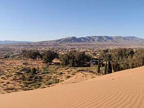 | |
 Location of Aïn Séfra within Naâma Province | |
 Aïn Séfra Location of Aïn Séfra within Algeria | |
| Coordinates: 32°45′N 0°35′W / 32.750°N 0.583°WCoordinates: 32°45′N 0°35′W / 32.750°N 0.583°W | |
| Country |
|
| Province | Naâma |
| District | Aïn Séfra (seat) |
| Government | |
| • PMA Seats | 11 |
| Elevation | 1,081 m (3,547 ft) |
| Population (1998) | |
| • Total | 34,962 |
| Time zone | CET (UTC+01) |
| Postal code | 45200 |
| ONS code | 4503 |
Aïn Séfra (Arabic: عين الصفراء, lit. yellow spring) is a municipality in Naâma Province, Algeria. It is the district seat of Aïn Séfra District and it has a population of 34.962, which gives it 11 seats in the PMA. Its postal code is 45200 and its municipal code is 4503. It is the second most populated municipality in the province after Mécheria.
Climate
| Climate data for Aïn Séfra | |||||||||||||
|---|---|---|---|---|---|---|---|---|---|---|---|---|---|
| Month | Jan | Feb | Mar | Apr | May | Jun | Jul | Aug | Sep | Oct | Nov | Dec | Year |
| Record high °C (°F) | 21.6 (70.9) |
24.1 (75.4) |
29.1 (84.4) |
32.3 (90.1) |
35.6 (96.1) |
40.1 (104.2) |
41.9 (107.4) |
42.9 (109.2) |
40.9 (105.6) |
32.4 (90.3) |
35.2 (95.4) |
24.0 (75.2) |
42.9 (109.2) |
| Average high °C (°F) | 12.4 (54.3) |
15.4 (59.7) |
17.4 (63.3) |
23.5 (74.3) |
27.4 (81.3) |
32.7 (90.9) |
37.6 (99.7) |
35.7 (96.3) |
32.1 (89.8) |
24.7 (76.5) |
16.3 (61.3) |
12.9 (55.2) |
24.0 (75.2) |
| Daily mean °C (°F) | 6.1 (43) |
8.4 (47.1) |
10.7 (51.3) |
15.7 (60.3) |
19.4 (66.9) |
24.1 (75.4) |
28.4 (83.1) |
27.2 (81) |
23.7 (74.7) |
17.1 (62.8) |
10.6 (51.1) |
6.9 (44.4) |
16.5 (61.7) |
| Average low °C (°F) | −0.3 (31.5) |
1.3 (34.3) |
4.0 (39.2) |
7.8 (46) |
11.4 (52.5) |
15.4 (59.7) |
19.2 (66.6) |
18.7 (65.7) |
15.3 (59.5) |
9.4 (48.9) |
4.9 (40.8) |
0.9 (33.6) |
9.0 (48.2) |
| Record low °C (°F) | −8.2 (17.2) |
−7.0 (19.4) |
−3.9 (25) |
1.0 (33.8) |
2.2 (36) |
7.9 (46.2) |
11.3 (52.3) |
13.5 (56.3) |
6.8 (44.2) |
3.3 (37.9) |
−4.0 (24.8) |
−10.2 (13.6) |
−10.2 (13.6) |
| Average precipitation mm (inches) | 10 (0.39) |
12 (0.47) |
16 (0.63) |
20 (0.79) |
12 (0.47) |
8 (0.31) |
6 (0.24) |
6 (0.24) |
16 (0.63) |
28 (1.1) |
19 (0.75) |
16 (0.63) |
169 (6.65) |
| Average precipitation days (≥ 0.1 mm) | 3 | 3 | 3 | 3 | 4 | 2 | 2 | 4 | 4 | 5 | 3 | 4 | 40 |
| Average relative humidity (%) (at 7:00) | 79 | 76 | 68 | 58 | 59 | 46 | 39 | 46 | 51 | 68 | 77 | 78 | 62 |
| Mean monthly sunshine hours | 223.2 | 240.1 | 279.0 | 282.0 | 328.6 | 354.0 | 362.7 | 344.1 | 309.0 | 254.2 | 195.0 | 201.5 | 3,373.4 |
| Mean daily sunshine hours | 7.2 | 8.5 | 9.0 | 9.4 | 10.6 | 11.8 | 11.7 | 11.1 | 10.3 | 8.2 | 6.5 | 6.5 | 9.2 |
| Source: Deutscher Wetterdienst[1] | |||||||||||||
Demographics
| Historical population | ||
|---|---|---|
| Year | Pop. | ±% |
| 1936 | 2,400 | — |
| 1954 | 20,100 | +737.5% |
| 1966 | 16,800 | −16.4% |
| 1987 | 23,800 | +41.7% |
| 1998 | 33,600 | +41.2% |
| Source: Populstat[2] | ||
See also
References
- ↑ "Klimatafel von Ain Sefra / Algerien" (PDF). Baseline climate means (1961-1990) from stations all over the world (in German). Deutscher Wetterdienst. Retrieved 22 October 2016.
- ↑ populstat.info

This article is issued from Wikipedia - version of the 10/22/2016. The text is available under the Creative Commons Attribution/Share Alike but additional terms may apply for the media files.