Agutaya
| Agutaya | ||
|---|---|---|
| Island Municipality | ||
|
Aguataya island, and small Oco island in the forefront | ||
| ||
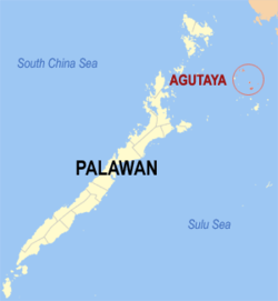 Map of Palawan with Agutaya highlighted | ||
.svg.png) Agutaya Location within the Philippines | ||
| Coordinates: 11°09′N 120°57′E / 11.150°N 120.950°ECoordinates: 11°09′N 120°57′E / 11.150°N 120.950°E | ||
| Country | Philippines | |
| Region | MIMAROPA (Region IV-B) | |
| Province | Palawan | |
| Congr. district | 1st district | |
| Barangays | 10 | |
| Area[1] | ||
| • Total | 37.31 km2 (14.41 sq mi) | |
| Highest elevation | 270 m (890 ft) | |
| Population (2010)[2] | ||
| • Total | 11,906 | |
| • Density | 320/km2 (830/sq mi) | |
| Time zone | PST (UTC+8) | |
| Zip Code | 5320 | |
| Dialing code | 48 | |


Agutaya is a fifth class island municipality in the province of Palawan, Philippines. According to the 2010 census, it has a population of 11,906 people.[2] It is the eastern part of the Cuyo Archipelago in the Sulu Sea, and the municipality covers several islands, including its namesake Agutaya Island, which is the second largest island of the Cuyo archipelago,[3] as well as Diit, Halog, Maracanao, Matarawis (also spelled Matarabis), Oco, and Quiniluban islands.
Barangays
The Municipality of Agutaya is politically subdivided into 10 barangays.[1]
- Abagat (Pob.)
- Algeciras
- Bangcal (Pob.)
- Cambian (Pob.)
- Concepcion
- Diit
- Maracanao
- Matarawis
- Villafria
- Villasol
Demographics
| Population census of Agutaya | ||
|---|---|---|
| Year | Pop. | ±% p.a. |
| 1990 | 6,052 | — |
| 1995 | 7,250 | +3.44% |
| 2000 | 10,422 | +8.09% |
| 2007 | 10,426 | +0.01% |
| 2010 | 11,906 | +4.95% |
| Source: National Statistics Office[2][4] | ||
Languages
Agutaya is home to a specific language, called the Agutaynen language, spoken by 10,000 people overall. Today, half of its speakers live in Agutaya, while the rest live in other communities of Palawan.[5] Tagalog and Cuyonon are also widely spoken.
Geography

Agutaya Island is the second largest of the Cuyo group with an area of about 4.5 square miles (12 km2). The north-eastern part is hilly. Four peaks tower over the island. The middle and highest of the four peaks, 885 feet (270 m) high, is covered with cogon, the others being wooded.[3]
Native sailboats used to be unable to sail to and from the nearby island of Cuyo (only 20 miles away), due to the strength of the monsoon, either the Northwest monsoon in wintertime, or the Southwest monsoon in summer.[6]
Volcano
Agutaya is an inactive volcano, 120 metres (390 ft) ASL, located at 11°09′N 120°57′E / 11.150°N 120.950°E, in the province of Palawan in the Philippines.
Philippine Institute of Volcanology and Seismology (Phivolcs) lists Agutaya as inactive.[7]
See also

- List of inactive volcanoes in the Philippines
- List of volcanos in the Philippines
- Pacific ring of fire
References
- 1 2 "Province: PALAWAN". PSGC Interactive. Makati City, Philippines: National Statistical Coordination Board. Retrieved 7 November 2012.
- 1 2 3 "Total Population by Province, City, Municipality and Barangay: as of May 1, 2010" (PDF). 2010 Census of Population and Housing. National Statistics Office. Retrieved 7 November 2012.
- 1 2 United States coast pilot, Philippine islands, Vol 2 Govt. print. off., 1921 p.35
- ↑ "Province of Palawan". Municipality Population Data. LWUA Research Division. Retrieved 18 July 2013.
- ↑ Proceedings of the seventh International Conference on Austronesian languages by Cecilia Odé, W. A. L. Stokhof, Rijksuniversiteit te Leiden. Vakgroep Talen en Culturen van Zuidoost-Azië en Oceanië, p.685
- ↑ The Gems of the East by A. Henry Savage Landor p.66
- ↑ Philippines Institute of Volcanology and Seismology (Phivolcs) List of Inactive Volcanoes
External links
- Philippine Standard Geographic Code
- Philippine Census Information
- Local Governance Performance Management System
 |
Culion / Sulu Sea | Magsaysay, Occidental Mindoro Mindoro Strait |
| |
| Linapacan / Sulu Sea Taytay / Sulu Sea |
|
Sulu Sea | ||
| ||||
| | ||||
| Araceli / Sulu Sea | Sulu Sea Cuyo / Magsaysay |
Puerto Princesa (capital) | |
| Municipalities | |
| Highly urbanized city |
|