Agra Canal
The Agra Canal is an important Indian irrigation work which starts from Okhla in Delhi. The Agra canal originates from Okhla barrage, downstream of Nizamuddin bridge.[1] It opened in 1874.
In the beginning, it was available for navigation, in Delhi, erstwhile Gurgaon, Mathura and Agra Districts, and Bharatpur State. Later, navigation was stopped in 1904 and the canal has since then, been exclusively used for irrigation purposes only. At present the canal does not flow in district Gurgaon, but only in Faridabad, which was earlier a part of Gurgaon.
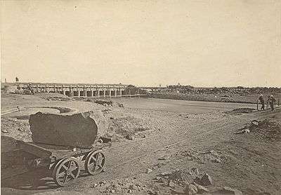
The Canal receives its water from the Yamuna River at Okhla, about 10 km to the south of New Delhi. The weir across the Yamuna was the first attempted in Upper India upon a foundation of fine sand; it is about 800-yard long, and rises seven-feet above the summer level of the river.
From Okhla the canal follows the high land between the Khari-Nadi and the Yamuna and finally joins the Banganga river about 20 miles below Agra. Navigable branches connect the canal with Mathura and Agra.[2] the canal irrigates about 1.5 lakh hectares in Agra, and Mathura in Uttar Pradesh, Faridabad in Haryana, Bharatpur in Rajasthan and also some parts of Delhi
References
- ↑ Agra Canal Modernization Project Archived March 18, 2008, at the Wayback Machine.
- ↑
 Chisholm, Hugh, ed. (1911). "Agra Canal". Encyclopædia Britannica (11th ed.). Cambridge University Press..
Coordinates: 28°34′N 77°18′E / 28.567°N 77.300°E
The Agra Canal also has many places to visit along its coast.