Agartala
| Agartala আগরতলা AGT | |
|---|---|
| Capital | |
|
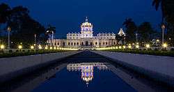
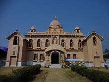
Ujjayanta Palace (Tripura State Museum) Agartala | |
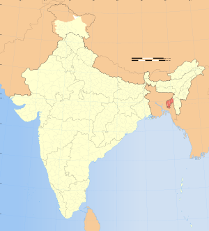 Agartala  Agartala Location of Agartala in Tripura | |
| Coordinates: 23°50′N 91°16′E / 23.833°N 91.267°ECoordinates: 23°50′N 91°16′E / 23.833°N 91.267°E | |
| Country |
|
| State | Tripura |
| District | West Tripura |
| Government | |
| • Type | Mayor–Corporation |
| • Body | AMC |
| • Mayor | Dr. Prafulla Jit Sinha[1] |
| • Commissioner | Dr. Milind Ramteke, IAS[2] |
| Area | |
| • Total | 76.504 km2 (29.538 sq mi) |
| Elevation | 12.80 m (41.99 ft) |
| Population (2015)[3] | |
| • Total | 522,613[4] |
| • Density | 6,831/km2 (17,690/sq mi) |
| Languages | |
| • Official | Bengali, Kokborok and English, |
| Time zone | IST (UTC+5:30) |
| PIN | 799001-10, 799012, 799014-15, 799022, 799055 |
| Telephone code | 91 (0)381 |
| Vehicle registration | TR 01 XX YYYY |
| Ethnicity | Bengali, Tripuri, Chakma, Others |
| Website |
agartalacity |
Agartala /əɡərtəˈlɑː/ (Bengali: আগরতলা Agortola) is the capital as well as the largest city of the Indian state of Tripura and also is the second largest city in North-east India after Guwahati, both in municipal area and population. The city is the seat of the Government of Tripura. Agartala is one of the fastest developing cities of India.
Agartala is a component of two words, namely "Agar", a kind of oily valuable perfume tree, + suffix "tala", a store house. The city is governed by the Agartala Municipal Corporation. Agartala lies on the bank of the Haora River and is located 2 km from the Bangladesh Border. Agartala is India's third international internet gateway after the ones in Mumbai and Chennai.[5]
The overall area of the Agartala Municipal Corporation was 76.504 Square Km and the population was 438,408 after the completion of the restructuring of the Agartala Municipal Corporation in 2013.[3] The percentage of literacy according to 2011 census was 93.88, higher than the national literacy rate.[6] As per Municipal Census of 2015, the population of Agartala is 522,613.[7]
History
Perched on the banks of River Haora, the capital city of Tripura-Agartala- entices sightseers with its past splendor. The name Agartala derives from the words 'Agar' and 'tala', a reference to the density of Agarwood trees in the region. The Agar tree was historically referenced in the story of the great king Raghu who tied up his Elephant's feet to an Agar tree on the banks of River Lauhitya. One of the earliest kings of Agartala was Patardan B.C. 1900 it was the time long before the Manikya Dynasties. Chitrarath, Drikpati, Dharmapha, Loknath Jivandharan were the important king during the time of B.C. in Agartala.

From the mythological, epigraphic and archaeological evidences excavated by the historians, it is clear that the glory of Tripura is a long-flourishing one. With early references in epic texts like the Mahabharata, the legacy and historical importance of this quaint city can be easily gauged. In the past, Tripura served as the capital to several noted Hindu kingdoms. Although a clear chronology of the rulers is not available, records reveal that the land has been ruled by as many as 179 Hindu rulers, starting from mythological King Druhya to the last king of Tripura, Kirit Bikram Kishore Manikya. Apart from the great Hindu rule, Tripura also witnessed the glorious rule of the Mughals. However, with the rise of British power in India, the state came under the governance of English in 1808.[8] Much later the ancient capital of the then Princely State 'Swadhin Tripura' was at Rangamati (Udaipur, South Tripura) by the bank of the river Gomati. In 1760 it was shifted by the Maharaja Krishna Chandra Manikya Bahadur (r.1829–1849) of Manikya Dynasty[9] to present old Agartala by the bank of the river Haora/Saidra and was named 'Haveli'. Due to frequent invasion of the Kuki's and also to keep easy communication with the British Bengal, the Maharaja Krishna Chandra Manikya started the process of shifting the capital from Old Haveli to New Haveli (present Agartala) in 1849. During the British Raj, Agartala was the capital of the erstwhile 'Hill Tippera' state, it became a municipality in 1874–75, and in 1901 had the population of 9,513.[10] The princely state always remained as cake piece to the British and many other invaders, such happened when the Arakhan soldiers did really attacked in the old capital of the state following which the king of Tripura responded them in a tricky way by defeating the entire troop. With the waves of Indian Independence, the people of Tripura started Ganamukti Parishad movement to include the state as the kingdom of India. The then queen of Tripura Maharani Kanchanprava Devi signed the agreement on 15 October 1949 permitting the government to merge the province with independent India. On 1 July 1963, Tripura became a centrally administered Union Territory and attained the status of full-fledged state on 21 January 1972. Agartala was named as the capital of Tripura.[11] The Agartala Municipality was established during the reign of Maharaja Bir Chandra Manikya (1862–1896) within an area of 3 square miles (8 km2) having a population of only 875 by a royal proclamation in the last part of 1871. Mr. A.W.S. Power, the first British political agent for Tipperah was also appointed as the Chairman of the Agartala Municipality in 1872 who held office from 1872–73. The municipality located at the crossing of Latitude N 23 –50' and Longitude E 91-17' covering 3 km2. Area during that period.[12]
Maharaja Bir Bikram Kishore Manikya Bahadur is called the founder of the planned city of Agartala. He had gone for a tour in the United Kingdom and after returning to his kingdom he decided that he would make Agartala a mini UK that was During the 1940s when the town area was re-organised in a planned manner with new roads and a market building making a good comfort for the people.
The population of Agartala was 367,822 in 2004 after the municipal expansion[13] (189,327 in the 2001 census).[14]
From 1901 to 1971 the city remained in a negligible development progress with only an 8 km2 or area but from 1981 Agartala started to expand and increase its connectivity in various fields along with its city area with 58.84 km2, greater Agartala is planned as of 2011 with an additional of 92 km2. Agartala had a different type of history from the earlier times of the epic days as it was a princely state and was connected with Bangladesh once upon a time. Though the East India Company has not arrived in this princely capital of the state but they always remained in a certain in capturing and ruling. The East India Company had set their base of North East India in the Assam province with Shillong as their capital.
The Nobel laureate Indian (Bengali) poet Rabindranath Tagore or Robindronath Thakur visited the city more than once and also built a house that still exists. The historical book Rajamal contains all incidents and the historal stories of Agartala .
Geography and climate
| Agartala | ||||||||||||||||||||||||||||||||||||||||||||||||||||||||||||
|---|---|---|---|---|---|---|---|---|---|---|---|---|---|---|---|---|---|---|---|---|---|---|---|---|---|---|---|---|---|---|---|---|---|---|---|---|---|---|---|---|---|---|---|---|---|---|---|---|---|---|---|---|---|---|---|---|---|---|---|---|
| Climate chart (explanation) | ||||||||||||||||||||||||||||||||||||||||||||||||||||||||||||
| ||||||||||||||||||||||||||||||||||||||||||||||||||||||||||||
| ||||||||||||||||||||||||||||||||||||||||||||||||||||||||||||
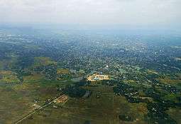
Agartala is situated in a plain along the Haora River, though the city also extends to the low-lying hills on its northern parts.
Agartala has a monsoon influenced humid subtropical climate with large amounts of rain almost all year. The city experiences long, hot and wet summers, lasting from April to October. Average temperatures are around 28 °C (82 °F), fluctuating with rainfall. There is a short, mild winter from mid-November to early March, with mostly dry conditions and average temperatures around 18 °C (64 °F). The best time to visit is from September to February. Summers are quite long and is extremely hot with a scorching sun and warm day. As mentioned rain is very common in the zone with[15](subscription required) and the city sometime remains or can be found flooded in the rainy season. The river Haora flows through the city and remains flooded with water during the time of monsoon.[16][17]
| Climate data for Agartala | |||||||||||||
|---|---|---|---|---|---|---|---|---|---|---|---|---|---|
| Month | Jan | Feb | Mar | Apr | May | Jun | Jul | Aug | Sep | Oct | Nov | Dec | Year |
| Record high °C (°F) | 31.9 (89.4) |
35.1 (95.2) |
38.9 (102) |
41.5 (106.7) |
42.2 (108) |
40.2 (104.4) |
37.7 (99.9) |
36.4 (97.5) |
36.1 (97) |
38.2 (100.8) |
34.2 (93.6) |
33.1 (91.6) |
42.2 (108) |
| Average high °C (°F) | 25.7 (78.3) |
28.5 (83.3) |
32.9 (91.2) |
34.2 (93.6) |
32.9 (91.2) |
31.5 (88.7) |
31.3 (88.3) |
31.5 (88.7) |
31.7 (89.1) |
30.9 (87.6) |
29.0 (84.2) |
26.4 (79.5) |
30.5 (86.9) |
| Average low °C (°F) | 9.8 (49.6) |
13.1 (55.6) |
18.6 (65.5) |
22.3 (72.1) |
23.6 (74.5) |
24.5 (76.1) |
24.7 (76.5) |
24.6 (76.3) |
24.2 (75.6) |
22.0 (71.6) |
16.5 (61.7) |
11.1 (52) |
19.6 (67.3) |
| Record low °C (°F) | 3.5 (38.3) |
4.7 (40.5) |
9.4 (48.9) |
13.2 (55.8) |
16.1 (61) |
18.9 (66) |
21.2 (70.2) |
20.0 (68) |
20.0 (68) |
14.6 (58.3) |
9.2 (48.6) |
2.0 (35.6) |
2.0 (35.6) |
| Average precipitation mm (inches) | 9.1 (0.358) |
19.7 (0.776) |
59.0 (2.323) |
182.1 (7.169) |
316.4 (12.457) |
455.3 (17.925) |
385.8 (15.189) |
312.8 (12.315) |
224.8 (8.85) |
165.2 (6.504) |
40.0 (1.575) |
8.4 (0.331) |
2,178.6 (85.772) |
| Average precipitation days | 0.7 | 1.7 | 3.3 | 7.8 | 11.4 | 17.4 | 16.4 | 16.4 | 11.8 | 7.3 | 2.0 | 0.3 | 96.5 |
| Source: India Meteorological Department (Period 1951–1980, record high and low up to 2010)[18][19] | |||||||||||||
Demographics
As of the 2011 Indian census,[6] In education section, total literates in Agartala city are 343,633 of which 174,524 are males while 169,109 are females. Average literacy rate of Agartala city is 93.88 percent of which male and female literacy was 95.75 and 92.02 percent respectively. The sex ratio of Agartala city is 1002 females per 1000 males. Child sex ratio of girls is 940 per 1000 boys.
In 1941 Agartala had a population of 17,693.[20] By 1991 the population had risen to 157,358.[21] Bengali, the official state language, is the dominant language in Agartala while English is also a popular language in the state, kokborok is spoken by the Tripuri people. According to the 2001 census, 87.70% of the population is Hindu, 8.27% Muslim, 1.88% Christian, and 1.90% Buddhist. The remainder of the population includes Sikhs, Jains, and other religions; 0.15%. The city mainly consists of Bengalis and Tripuris. Bengali is widely spoken in the city as a result of the erstwhile regal patronage and high influx of Bengalis from Comilla, Sylhet, Noakhali, Chittagong districts of Bangladesh. Durga Puja and Saraswati puja are celebrated with great grandeur and ecstatic enthusiasm, which reflect the influence of the culture of the Bengalis. The inter-cultural, inter-communal integrity is rather wonderful. Hence, nearly every festivity attracts participation from citizens of diverse and vibrant backgrounds.[22]
There is also a growing population of the native Tripuri people in the city. Among the native Tripuri festivals, the most famous are Kharchi,Garia & Ker festivals and Tring, the Tripuri New year celebrations. The major areas where the native Tripuri people live are in the localities of Abhoynagar, Banamalipur, Krishnanagar, Nandannagar and Kunjaban areas who have started to mass migrate to Agartala from other parts of Tripura.[23]
| Year | Population | Area |
|---|---|---|
| 1901 | 6,415 | 3 square miles (8 km2) |
| 1911 | 6,831 | 3 square miles (8 km2) |
| 1921 | 7,743 | 3 square miles (8 km2) |
| 1931 | 9,580 | 3 square miles (8 km2) |
| 1941 | 17,693 | 3 square miles (8 km2) |
| 1951 | 42,595 | 3 square miles (8 km2) |
| 1961 | 54,878 | 3 square miles (8 km2) |
| 1971 | 100,264 | 3 square miles (8 km2) |
| 1981 | 132,186 | 10.94 km2 |
| 1991 | 157,358 | 15.81 km2 |
| 2001 | 188,540 | 16.02 km2 |
| 2004 | 367,822 | 58.84 km2 |
| 2011 | 399,688 | 58.84 km2 |
| 2013 | 438,408 | 76.504 km2 (Greater Agartala Planning Area: 512,264 and 92 km2) |
As seen clearly from 1901, Agartala was once a very backward and had a rural climate of land. Literacy was almost to nil, with only an 8 km sq of land piece as a city part Agartala was in no doubt as one of the lacking places in the entire sub-continent. But after the establishment of the AMC things began to change in a pretty smooth way. As it is of now the present area of the land is 58 km2 and an additional area of 92 km sq. It is believed to have the fastest one of the fastest development State in Northeast India besides poverty, limited literacy in some remote areas, etc. still remains a big challenge in here. Govt is trying to establish a better zone and a good education facility for all.
Localities in the city
Agartala city consists of many Paras, which means "locality" in Bengali. Each collections of neighbourhood or para is usually a municipal ward or division also.
Neighborhoods and localities
Neighborhoods of the city include; Banamalipur as one of the important areas in the state, mainly comprising localities and also an important business centre, it is a party of the main urban Agartala which falls under Agartala post office following with pin as 799001, Dhaleswaris a locality in the state close to Banamalipur, it is under the East police station and Dhaleshwar post office, pin is under this region 799007.
Pratapgar, Math Chowmuhani, Kashari Patti, Ker Chowmuhani are some important places in the city. One of the famous and largest banayan tree is located in ker Chowmuhani.Under that tree lies the famous Shiv-Kali temple of Ker Chowmuhani.This is one of the most peaceful temple in Agartala. In local language "Chowmuhani" is an intersection of three or four roads, i.e., a place where couple of roads are linked up crossed a particular point, in pure Bengali Chowmuhani is called "more".
Kaman Chowmuhani is the most important place and a part of the heart of the city. The name Kaman Chowmuhani derived from the Bengali word Kaman meaning "Tank" in Bengali. It so happened when the king of Tripura defeated the Arakhan soldiers in a battle and forfeited their tank and later it was set up in this place by which its name is derived. The place along with its object is a unique icon of Agartala.
Krishnanagar is one of the most densely populated parts of the city. It constitutes the most visited temples of Agartala like Jagannnatha temple, Laxminarayana temple, Durgabari temple and Alpkhbaba temple. Most popular restaurants of the city like Momos n More, Chathainog, Abba Cafe, Samba and Tandoori Hut are located here. This place is very popular among the youngsters and very common place for hanging out. Radha Nagar has a prominent bus stand and it connects buses and other vehicles to the northern part of the state. Shibnagar is another locality which connects the city to Maharaja Bir Bikram College, the oldest college of the state where as Ramnagar is the most dense locality in Tripura. The rectangular Gridiron network of Ramnagar dated from the rules of the Rajas, one of the earliest planned neighbourhood in the city. There are 12 division in this area lots of clubs are present here which conducts Durga puja. Joynagaris a locality in Agartala, It has 6 lanes. There are 4 clubs conduction Durga puja. The closest landmark of Joynager is Battala market one of the important business hub in the State.
Abhoynagar and Arundhutinagar are two residential areas in the city and is densely populated where as the other one (Arundhutinagar) is located 5 km away from the city centre, the railway station of the capital city is located in here.
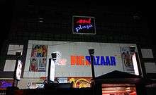
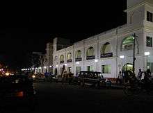
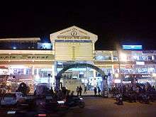
Gol Bazar is the most important business hub as well as the biggest market in the state of Tripura. Products are exported to many Indian cities from this zone. The market was Established by the king of Tripura before India's independence.
Gurkha Basti is one of the biggest slum areas in the city, a recent campaign has been launched by the State Government to make the city slum free and hence excavation of the people is on the way and they are provided land somewhere in the city. Coming to Kunjaban is a census town in west Tripura district, which mainly includes government buildings and localities. The secretariat and the seat of the state government is located in this area. New Capital Complex is located in Kunjaban, it is a planned and a modern area in the city, secretariat and the State Assembly along with the new Governor House is located here.
College Tilla consists of the historic Maharaja Bir Bikram College which was set up by Maharaja Bir Bikram Kishore Manikya in 1947. It is surrounded by some localities and quarter complexes of many government employees. MBB Club, Indranagar, Bholagiri and Bhati Abhoynagar are some residential places in the city. 79 Tilla is another important part of Agartala with major offices such as the BSNL Office, Electric office, Geological Survey office and Quarters, and the AG Quarters.It is located 2.5 km approx from the heart of the city.
GB Bazar is another important market of this state which is located 2 km approx from the heart of the city. The Agartala Government Medical College is located in here.
Amtali, Badhar Ghat, College Tilla, Jagaharimura, Lake Chowmuhani, Advisor Chowmuhani, Ganaraj Chowmuhani, Durjoynagar, Bardowali are some important places in the city.
Battala is the commercial point of the city, it is often called Bottala in Bengali. Very good of electrical products also known as the electronics market of Agartala. Products are imported from abroad and also the cheapest variety of cloths and accessories are found, besides Battala also has a strong point of food market and it is the 2nd biggest market of Tripura after Gol Bazar.
Melarmath is one of the most important parts of the city and also the Business hub centre of the city of Agartala; the City Center is located in that zone also other important landmarks can be found. Melarmath Kali Bari temple is one of the famous temples in Agartala.
Khayerpur and Chandrapur are located on the National Highway 44.
These areas are subdivided into residential blocks, such as Banamalipur which is divided into North Banamalipur, Madhya Banamlipur, South Banamalipur, etc.
From 2004 the Agartala Municipal Council has been further extended, taking 16 Grams of Dukli R. D. Block, seven Grams of Mohanpur R. D. Block and two Grams of Jirania R. D. Block with area of 43 km2. and 178,495 population in addition to the 16 km2 and population of 200,000 in 2001 census.[25][26]
City administration
The Agartala city is managed by the Agartala Municipal Corporation, AMC, which divides the city into wards. Each ward has an elected ward representative or municipal councillor. For postal administration the city is divided into postal zones. Municipal wards and their locations are as of below in table.[27]
| Ward No. | Para / Locality | Municipal Zone |
|---|---|---|
| 1 | Barjala | North |
| 2 | Chandinamura-Lichubagan | North |
| 3 | Kunjaban | North |
| 4 | Chanmari | North |
| 5 | Indranagar | North |
| 6 | Nandannagar | North |
| 7 | Abhoynagar | North |
| 8 | Radhanagar | North |
| 9 | Ranjitnagar | Central |
| 10 | Rajnagar | Central |
| 11 | Paschim Jaynagar | Central |
| 12 | Ramnagar | Central |
| 13 | Paschim Krishnanagar | Central |
| 14 | Krishnanagar | Central |
| 15 | Dimsagar-Banamalipur | Central |
| 16 | Dhaleswar | East |
| 17 | Kashipur-Khayerpur | East |
| 18 | Shibnagar | East |
| 19 | Paschim Shibnagar | East |
| 20 | Town Pratapgarh | Central |
| 21 | Shantipara | Central |
| 22 | Melarmath | Central |
| 23 | Bardowali | South |
| 24 | Bhattapukur-Badarghat | South |
| 25 | Arundhutinagar | South |
| 26 | Dakkhin Badarghat | South |
| 27 | Siddhi Ashram | South |
| 28 | Rajlaxminagar | South |
| 29 | Arundhutinagar | South |
| 30 | Paschim Pratapgarh | South |
| 31 | Purba Pratapgarh | South |
| 32 | Jogendranagar | East |
| 33 | Uttar Jogendranagar | East |
| 34 | Aralia | East |
| 35 | Purba Jogendranagar | East |
Politics
On 1 November 1956, Tripura became a Union Territory and an Advisory Committee was formed to advise the Chief Commissioner. On 15 August 1957, a Territorial Council was formed with 30 elected members and two members nominated by the Government of India. On 1 July 1963, the Tripura Territorial Council was dissolved and a Legislative Assembly with the existing members of the Territorial Council was formed. Tripura is governed through a parliamentary system of representative democracy, a feature it shares with other Indian states. Universal suffrage is granted to residents. The Tripura government has three branches: executive, legislature and judiciary. The Tripura Legislative Assembly consists of elected members and special office bearers that are elected by the members. Assembly meetings are presided over by the Speaker or the Deputy Speaker in case of Speaker's absence. The Assembly is unicameral with 60 Members of the Legislative Assembly (MLA).[28] Agartala assembly constituency is part of Tripura West.[29] Agartala has always been in a ripen fruit to all the political parties and as a result clashes between Communist Party of India (Marxist) and Indian National Congress has always been a common thing to see. After the independence of India in 1947 Tripura was still a princely state. After death of the last king Maharaja Bir Bikram Kishore Manikya on 17 May 1947, a Regency Council was formed headed by Maharani Kanchan Prava Devi, for aid of the minor Prince, Kirit Bikram Kishore Manikya Bahadur. The regent signed the merger agreement with the Government of India. After merger Tripura became a Part 'C' State. On reorganisation of the states, effected in November 1956, Tripura became a Union Territory with an Advisory Committee to aid and advise the Chief Commissioner. Tripura gained its state hood on 21 January 1972 before that but merging with India in 1949 the first chief minister of the state was on 1 July 1963, Sachindra Lal Singh of the Indian National Congress, he was the CM of the state for around 3046 days. From 5 January 1978 the rule of the congress came to an end as Nripen Chakraborty became the first Communist chief minister of Tripura. Later again the communist fell and the INC rose and was in power till 1992, from 1993 again CPI(M) came to power and is continuing till now. Manik Sarkar is the current CM of the state from 11 March 1998.
Agartala is administered by several government agencies. The Agartala Municipal Corporation, or AMC, oversees and manages the civic infrastructure of the city which together encompass 49 wards. Each ward elects a councillor to the AMC. Each borough has a committee of councillors, each of whom is elected to represent a ward. By means of the borough committees, the corporation undertakes urban planning and maintains roads, government-aided schools, hospitals, and municipal markets.
Economy

The city is the state capital. Most of the population is employed in the state and central government, and other government owned enterprises. Since liberalisation in the early nineties the economy of India has seen tremendous growth which was not stalled even by the dot com bubble burst in 2000 and the recession of 2009. But the economy of Agartala has not been developing in tandem with the economy of the country till the year 2000. The development has been quite slow; though lot of consumer brands in telecom and retail have entered Tripura but that would be mainly because the markets in tier 1 and tier 2 cities have saturated and they are looking for new territories to expand their business. Entry of MNCs and the rise of Indian giants have provided the perennially cash starved middle class with higher disposable income, but Agartala seems to have not benefited much from it. There are handful of private companies in the state so majority of the people have govt. So the population with high disposable income is quite low in the state. The young population between the age group of 23–40 are major spendthrifts; they also constitute the major part of the Indian population. NIT, Tripura Medical College, MBB College, Tripura University, [ICFAI UNIVERSITY] etc. are few good and prominent colleges in the state in which students find better than the other colleges in the state, a major chunk again leaves for job in the big metros of India.
We all know that the economy develops when the spending of the population increases, this was the reason behind the booming of American, Japanese or Korean economy. Even the Indian cities like Mohali, Surat, Coimbatore etc. sees high consumer spending and are doing good. The buying pattern of the consumers of Agartala had evolved quite a lot after the expansion of the city and the rise in population; earlier the major buying took place once a year i.e., during Durga puja while the rest of the year buying took place only for occasions like marriage, birthday etc. but nowadays shopping has become a fashion to everyone in Agartala, the opening of the city centre, malls, etc. had increased the demand of purchasing goods to the people here. The buying is decided and the instances of impulse buying are moderately high as compared to the past decades. The retail space of Agartala before was that it didn't encourage much of impulse buying. The shopping malls are major places of hang out for both young and old, lot of people of who go to malls to do window shopping and pass some time end up buying something. The city centre at Agartala is a substitute for a mall, another is the Battala super market which is also one of the main hub of markets of Tripura. Brands like Titan, Titan Eye +, Fastrack, Reebok, John Player, Lee, adidas, Puma, Nike, Levis had opened and are moderately good here. The people of Agartala have high aspiration the reflection of which we can see in the buying pattern of cell phones and two-wheelers. The retail brands have to just educate the consumer about themselves; they have to incentivise them to spend more than the planned shoppings.[30]
Public sector
Major PSUs in Agartala are:
- ONGC
- GAIL
- BSNL
- Airports Authority of India (AAI)
- NEEPCO[31] (North Eastern Electric Power Corporation Limited)
- TSECL (Tripura State Electricity Corporation Limited)
The major commodities exported from Agartala are tea, rubber, bamboo stick & Agarbatti, Bamboo Handicrafts and gas/LPG.
Culture
.JPG)
Agartala has got a mixed type of religion and is similar as compared to the other states of India.[32] Hinduism is the dominant religion and there are many temples across the city. The Durga Puja season is generally the busiest time of the year and one can then experience the richness of Indian cultural extravaganza. Agartala is also known for its tribal festivals like Kharchi, and Garia Puja.[33]
Temples
Some prominent temples are:
- Lakshmi Narayan Temple, the Palace Compound.
- Jagannath Temple.
- Ram Thakur's Ashram in Banamalipur.
- Durga Bari Temple in the Palace Compound
- Pagla Debata Temple, Agartala Old Motorstand
- Motorstand Shani Mandir.
- Satsanga Bihar, Krishnanagar
- Ker Chowmuhani Shiv-Kali temple.
- Kalibari Temple in the Palace Compound
- Iskcon Temple (Hare Krishna Temple)-SRI SRI RADHA GOVINDA MANDIR
- Baba Loknath Temple, Laxmi Narayan Bari Road
- Umamaheshwar Temple(Shibbari), Central Road
- Ramkrishna Mission, Math Chowmani (Near Dhaleswar), Gandhi Ghat & Amtali
- Bharat Sevashram Sangha
- Bhavatarani Temple, Melarmath
- Pagli masi Temple, Melaghar
- Universal Prayer Hall is at the Ramakrishna Mission Dhaleswar Complex in Agartala.
Mosques
- Gedu Miyar Masjid
- Jame Masjid, Bhati Abhoynagar (West)
Monasteries
- Benuban Bihar, Kunjaban
Churches

- Agartala Baptist Church, Arundhutinagar, the oldest church in Agartala
- Agartala City Baptist Church, Supari Bagan
- Khakotor Baptist Church, Abhoynagar
- Capital Baptist Church, Gurkha Basti
- Capital Baptist Church, Nandannagar
- Palace Baptist Church, Palace Compound
- Aguli Baptist Church, Bidhurkarta Chowmuhani
- Noyung Baptist Church, Haradhan Sangha
- St. Joseph's Catholic Church, Durjoynagar[34]
- Don Bosco Catholic Church, Nandannagar
- Catholic Church, Mariamnagar, the first Christian community in Tripura[35]
- Presbyterian Church, Shyamali Bazaar
Connectivity
Airport
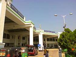
Agartala is connected by air, via Agartala Airport which connects it to other cities in India. There are direct flight connections to Kolkata, Imphal, Delhi, Silchar, Aizwal, Guwahati, Bangalore, Chennai, Ahmedabad and Mumbai. Agartala airport is the Second busiest airport in north east India after Guwahati. The airport is located in Singerbhil 12.5 km (6.7 nautical miles) northwest from the heart of the city of Agartala. The major airlines are Air India, IndiGo and SpiceJet.
Planning is going on to upgrade the Airport building with better facilities & modern equipments along with more apron, expansion of runway better CAT and navigation system[36]
Roads
National Highway 44 connects Agartala to Assam and the rest of India by road, also known as the lifeline of Tripura. The highways (NH44, NH 44A) connects Agartala with Silchar (317 km), Guwahati (599 km), Shillong (499 km), Dharmanagar (200 km) and Aizawl (443 km). A bus service connects it to Dhaka (150 km).
- National Highway 44 (India) – Connected to Tripura to Shillong & Mizoram(NH 44A)
- National Highway 44A (India) – Connected to Tripura to Mizoram
Agartala is well connected by road to other parts of Tripura state. National Highway 44 has been extended to the south, thus improving the road connectivity between Agartala and south Tripura. Buses, Jeeps, Trekkers and SUVs are the most popular public carriers, and cars and vans are usually used for private hire. The Highway generally passes through hilly terrains, while travelling from the city towards the North one can experience the lavishing and lush green Baramura Hill Range Atharamura Hills and the Longtharai Hills and while moving towards the South Debatamura Hills can be seen.
The main mode of public transportation within the city consists of a network of cycle rickshaws, auto rickshaws and buses.
Railways
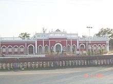
Agartala has been connected to other cities in India since June 2008 through Agartala Railway Station. The foundation stone for the 119 km Kumarghat-Agartala railway project was laid in 1996 by former prime minister H D Deve Gowda.
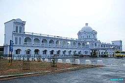

Agartala is the second capital city (after Guwahati, Assam) in the northeast which is connected to the country's railway network. The railway station is located approximately 5.5 km (2.96 nautical miles) from the heart of the city and a lot of modes of transportation are available to reach the city from the station. The lines connect from Lumding with a meter gauge track to Agartala and is almost in its way for a connection towards the extreme end point of the state to sabroom. There were total 14 stations in Tripura with Churaibari being the last one in the North. New stations in South are under construction. Total length of track in this state is approximately 153 km following which the territory of Assam starts.
Expansion of the station and laying more tracks is under way, which will increase the traffic and passenger capacity, and set up a completely new broadgauge track for faster trains and more comfortable journey.
Broad-gauge conversion work in the Lumding-Silchar segment was completed in March 2015. Gauge conversion work till Agartala is completed by the end of March 2016 & trains between Agartala & Silchar started. During the laying of rail lines from Kumarghat to Agartala, provisions were kept for swiftly converting it to broad gauge. Presently local trains between Agartala to Dharmanagar and Silchar is functional Also express train connecting Agartala to Delhi,Kolkata,Guwahati and Dibrugarh has started.
A rail link between Agartala and Akhaura in Bangladesh was approved by the Government of India in September 2011.[37] IRCON is constructing this 15 km long track that will directly connect northeast India to Chittagong international sea port. The construction would begin in 2015.[38]
Communications
Radio stations

Television
Doordarshan (DD) has a television station in Agartala. Akash Tripura is one of the first television channels in Agartala. It is a full-time Agartala-based news channel. Other full-time based channels are Headlines Tripura,[39] News Vanguard, Awaaz.
Khabar 365 is the only satellite channel in the state. There are other cable channels such as - Hallabol, T.TV, Sristi Tripura, Sristi music, sristi Bangla, sristi cinema, CITI, News all India, Tripura pratidin etc. etc. which are not 24 hours channel and are run by Siti & Sristi Cable networks.[40]
Newspapers
Bengali-language media is dominant in the city. Major news publications are:
- Dainik Sambad (Bengali)
- Syandhan Patrika (Bengali)
- Tripura Darpan (Bengali)
- Tripura Times (English)
- Ajker Fariad (Bengali)
- Bartaman (Bengali)
- Daily Desher Katha (Bengali)
- Sakalbela (Bengali)
- Aajkaal (Bengali)'
- Tripura Samay
- Dainik Ganadoot(Bengali)
- Pratibadi Kalam(Bengali)
- Sandho Tripura(Bengali)
- Agartala News(Bengali/ English)
Education
Universities
- Tripura University- A Central University
- ICFAI University, Tripura
- IGNOU Center, MBB College
- Sikkim Manipal University Agartala Center
- National Institute of Technology Agartala
Colleges
- General Degree Colleges
- Maharaja Bir Bikram College
- Bir Bikram Memorial College
- Women's College
- Ramthakur College
- Holy Cross College, Agartala
- Technical Colleges

- National Institute of Technology, Agartala
- Tripura Institute of Technology
- Tripura College of Agriculture
- College of Fisheries (CF), Lembucherra (Under CAU, Imphal)
- Women's Polytechnic
- Bhavan's Tripura College of Science and Technology
- Medical and Nursing Colleges

- Agartala Government Medical College
- Tripura Medical College & Dr. B. R. Ambedkar Memorial Teaching Hospitlal, Agartala
- Regional Institute of Pharmaceutical Sciences And Technology(RIPSAT), Abhoynagar
- Tripura Institute of Para-Medical Sciences, Amtali
- College of Veterinary Sciences and Animal Husbandry (R K Nagar)
- Institute of Nursing Science
- Tripura College of Nursing
- Govt tie up national college-
- Aditya institutions (www.adityaedu.net), Karnataka
- RR Institutions[Bangalore]
- Other Professional Colleges
- Tripura Government Law College
- Institute of Advance Studies in Education
- Bhavan's Tripura College of Teacher Education
- Colleges for Arts & Music
- Sachin Deb Barman Memorial Govt. Music College
- Govt. College of Art & Craft
- Tripura Tribal Folk Music College (Khumlung)
Prominent schools
- Umakanta Academy Estd-1890
- St. Xavier's Higher Secondary School,Don Bosco, Bishramganj Estd-1986
- Maharani Tulsibati Girls H.S. School
- Bhavan's Tripura Vidya Mandir Estd.1996
- Holy Cross School Estd-1970
- Pranavananda Vidyamandir,Agartala
- Shishu Bihar Higher Secondary School
- Ramakrishna Mission Vidyalaya, Amtali[41]
- Sri Krishna Mission School,
- Hindi Higher Secondary School (CBSE)
- Kendriya Vidyalaya, Kunjaban
- Kendriya Vidyalaya O.N.G.C
- Bardowali Higher Secondary School
- Ramakrishna Vivekananda Vidyamandir
- Shiksha Niketan Higher Secondary School
- Don Bosco School
- St. Paul's School
- Budhjung H.S. School (Boys)
- Budhjung Girls H.S. School
- Netaji Subhash Vidyaniketan
- BaniVidyapith School
- Pragati Vidhyabhaban
- Sankara Charaya Vidyayatan
- Jawahar Navodya Vidyalaya
- Auxilium Girls' School
- Kidzee Agartala Preschool, 79 Tilla, G.B
Sports

Tripura is an important state in the North East India regarding sports, many sports and games are played. Cricket is the most important sport in the state side by side football also has an important role.
Football
There are lots of football fans present here. UK mini stadium is an important venue for this game. Tripura Football Association organises a football league known as Agartala League every year to popularise the sport in the state. The main football stadiums are the Badarghat Stadium and the Umakanta Academy Mini-Stadium.
Cricket
Tripura has a state team which plays under Tripura Cricket Association in the Eastern division of the Ranji Trophy Championship, the national cricket competition of India. Cricket is widely played in Maharaja Bir Bikram College Stadium and TIT Cricket Ground, Narsingarh.
Stadiums
The following are the stadiums in Agartala-:
- Maharaja Bir Bikram College Stadium - the premier cricket stadium in the city with a capacity of 30,000 persons.
- Badharghat Stadium - the premier football stadium in the city.
- Polytechnic Institute Ground- the second cricket stadium in the city with capacity of 15,000 persons.
- Swami Vivekananda Stadium - another multi-purpose stadium in the capital city of Tripura in Agartala. Located around 2 km away from the city centre, the stadium has a sitting capacity around 8000 including a grand stand and press gallery. The area of the inner ground is 7350 sqm. Considered as the most highly moderniser and the best stadium in entire Northeast India[42]
- Umakanta Academy Mini-Stadium
Tourism
Places of interest
- College Tilla – Maharaja Bir Bikram College, Tripura University buildings, football ground, international cricket stadium, picturesque lush landscapes and serene natural lakes. It is also a National Bird Sanctuary
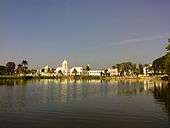
- Ujjayanta Palace – Palace of the Tripura kings, was converted to state legislative assembly & now into a museum, situated in the area of Palace Compound is one of the eye catching attraction in the state. Its a former royal palace in Agartala, the capital of the Indian state of Tripura, and also served as the meeting place of the Tripura Legislative Assembly until 2011. The area has decoded from the ruling landmark of the kings to the citizens. Ujjayanta Palace is a tourist attraction of Agartala, and tours are conducted by the Tripura Tourism Department. The name Ujjayanta Palace was given by the famous poet Rabindranath Tagore, the famous poet visited the state of Tripura quite a certain amount of times, he had a different heart for this kingdom and loved it a lot. Maharaja Bir Bikram was the last king of Tripura who ruled the state and was also the last king who stayed in his house in the palace.
- Jagannath temple — Hindu temple of Vaishnava school of thought. It has now been transformed into a museum named Ujjayanta Museum and it was inaugurated by Dr. Hamid Ansari, The Vice-President of India
- Umamaheswar temple — Hindu temple of Shaiva and Shakti(durga).
- Venuban Buddha Vihar - Distance of around 2 km inside the city of Agartala from the City centre is located the Venuban Vihar where a Buddha shrine houses a metal idol of Lord Buddha. The idol was primitively created in Burma and was later transported to Venuban Vihar for instalment into this shrine. The function of Buddha Poornima is yearly celebrated with full colour and fervor. The solemnisations are followed by a large fair.[43]
- Krishna Mandir
- Puratan Agartala (Old Agartala)
- Malancha Niwas- Kabiguru Rabindranath Tagore, the first Asian Nobel Laurete had stayed here during his visit to Tripura.
- Rose Valley Amusement Park, Amtali
- Agartala City Centre – The main hub point in the city, located in Paradise Chowmuhuni carries a lot of attraction in the capital
- Agartala Secretariat – Located approx 3 km from the heart of the city is indeed a splendid to watch the biggest Government building in Northeast India.
Parks
- Rabindra Kanan
- Children's Park
- Nehru Park
- Kishans park
- Rose valley park
- Heritage Park
Museums
- Tripura State Museum is located at the Ujjayanta Palace.
- Science Museum, located in Sukanta Academy
- Haveli Museum, located in Kashipur
Notable people
- S.D.Burman, music director in Bollywood[44]
- R.D.Burman, music director in Bollywood[44]
- David Dhawan,is an Indian Bollywood film director.[45]
- Somdev Devvarman, professional Indian tennis player
- Sourabhee Debbarma, singer (winner of Indian Idol 4)
- Reema Debnath, actress in Bollywood,[46][47]
- Arundhati Hom Chowdhury, Bengali (Rabindra sangeet) singer[48]
- Dipa Karmakar, the first Indian woman to win a bronze medal in 2014 Commonwealth Games[49]
- Chandra Shekhar Ghosh, founder of Bandhan Bank
See also
- List of cities and towns in Tripura
- Tourism in North East India
- Centre for Forest Based Livelihood and Extension Agartala
- Advanced Research Centre for Bamboo and Rattan
References
- ↑ "Agartala Municipal Corporation". Agartalacity.tripura.gov.in\accessdate=2015-05-07.
- ↑ http://agartalacity.tripura.gov.in/
- 1 2 "The first news, views & information website of TRIPURA". Tripurainfo. Retrieved 2013-12-20.
- ↑ www
.tripurainfo Municipal Census 2015.com /info /ArchiveDet .aspx?WhatId=15446 - ↑ "Agartala becomes India's third int'l internet gateway".
- 1 2 "Agartala City Population Census 2011 | Tripura". Census2011.co.in. Retrieved 2013-12-20.
- ↑ www
.tripurainfo Notification for delimitation of civic wards issued, tripurainfo.com.com /info /ArchiveDet .aspx?WhatId=15446 - ↑ http://iloveindia.com/travel/agartala/history-of-agartala. Retrieved 20 December 2013. Missing or empty
|title=(help) - ↑ "UQconnect, The University of Queensland". Uq.net.au. Retrieved 2014-02-02.
- ↑ Agartala The Imperial Gazetteer of India, 1909, v. 5, p. 70.
- ↑ "History Of Agartala - Agartala History". Iloveindia.com. Retrieved 2013-12-20.
- ↑ "Agartala Municipal Council". Agartalacity.nic.in. Retrieved 2013-12-20.
- ↑ Agartala Municipality Statistics Archived 4 May 2006 at the Wayback Machine., provided by the AMC(Agartala Municipal Council) at the Government of Tripura website Archived 4 May 2006 at the Wayback Machine.
- ↑ Indian Census Archived 12 May 2008 at WebCite
- ↑ "Hurricane Risk Landfall Options". Weatherinfo.com. Retrieved 2014-02-02.
- ↑ "Agartala, India Weather Forecast from Weather Underground". Wunderground.com. Retrieved 2013-12-20.
- ↑ "About India, India Travel Guide, Holiday Packages, Tour & Travel Packages". Mustseeindia.com. Retrieved 2014-02-02.
- ↑ "Agartala Climatological Table, Period: 1961–1990". India Meteorological Department. Archived from the original on 2012-02-18. Retrieved May 16, 2014.
- ↑ "Ever recorded Maximum and minimum temperatures upto 2010" (PDF). India Meteorological Department. Archived from the original (PDF) on 21 May 2013. Retrieved May 16, 2014.
- ↑ Columbia-Lippincott Gazeteer. p. 18
- ↑ Cohen, Saul B., ed. Columbia Gazeteer of the World (New York: Columbia University Press, 1998) p. 26
- ↑ "Travel Guide for South Asia: India, Sri Lanka, Nepal, Bhutan, Maldives". Travelomy. Retrieved 2014-02-02.
- ↑ "Agartala". Triposo.com. Retrieved 2013-12-20.
- ↑ "Census of India – Socio-cultural aspects". Government of India, Ministry of Home Affairs. Retrieved 2 March 2011.
- ↑ Agartala Municipality Statistics Archived 4 May 2006 at the Wayback Machine. Archived 4 May 2006 at the Wayback Machine.
- ↑ Agartala Statistics and future outlook Archived 28 September 2006 at the Wayback Machine. Archived 28 September 2006 at the Wayback Machine.
- ↑ agartalacity
.tripura Agartala municipal wards map (bengali).gov .in /map .htm - ↑ "Tripura Legislative Assembly". Legislative Bodies in India. National Informatics Centre. Retrieved 21 April 2007.
- ↑ "Assembly Constituencies — Corresponding Districts and Parliamentary Constituencies" (PDF). Tripura. Election Commission of India. Archived from the original (PDF) on 8 November 2005. Retrieved 8 October 2008.
- ↑ "A Perspective on Economy of Agartala". The Tripura Foundation. 2011-05-17. Retrieved 2013-12-20.
- ↑ http://www.neepco.gov.in/
- ↑ "Culture in Agartala|Agartala Place of Visit". Travel.sulekha.com. Retrieved 2013-12-20.
- ↑ "Agartala Travel Information: Agartala Travel Guide, Agartala Sightseeing, Agartala Distances, Agartala Climate". TravelMarg.com. Retrieved 2013-12-20.
- ↑ "Diocese of Agartala". Agartaladiocese.org. Retrieved 2014-02-02.
- ↑ "Mariamnagar". Donboscosilchar.org. 2011-11-18. Retrieved 2013-12-20.
- ↑ http://www.economictimes.com/news/news-by-industry/transportation/airlines-/-aviation/upgradition-of-imphal-airport-next-month-agartalas-by-next-2-1/2-years/articleshowdown/20462224.cms. Retrieved 11 July 2013. Missing or empty
|title=(help) - ↑ "India approves new railway link with Bangladesh". TwoCircles.net. Retrieved 2013-12-20.
- ↑ "Work on Agartala-Akhaurah railway line to begin in 2015". IANS. news.biharprabha.com. Retrieved 17 June 2014.
- ↑ "Tripura Homepage". Headlinestripura.net\accessdate=2015-05-07.
- ↑ "Archived copy". Archived from the original on 11 February 2011. Retrieved 2014-06-18. Archived 11 February 2011 at the Wayback Machine.
- ↑ Ramakrishna Mission School
- ↑ "Welcome to Tripura Infoway". Tripurainfoway.com. Retrieved 2013-12-20.
- ↑ "Venuban Vihar in AGARTALA - Popular Attraction in Agartala - BUDDHA SHRINE Tripura India". Retrieved 24 January 2015.
- 1 2 "S.D.Burman and R.D.Burman". Music Director.
- ↑ "Govinda is a delight for the director: David Dhawan". The Times of India.
- ↑ Chakraborty, Tanusree (4 September 2011). "northeast-girl-makes-it-big-in-bollywood". The Shillong Times. Retrieved 4 September 2011.
- ↑ "Reema Debnath". Actress.
- ↑ "Arundhati Hom Chowdhury Biography by Joy Mukherjee". Retrieved 24 January 2015.
- ↑ "Bronze-Winning Indian Gymnast Dipa Karmakar Toast of Tripura". NDTV.com. Retrieved 24 January 2015.
External links
| Wikimedia Commons has media related to Agartala. |
- Agartala Municipal Corporation
-
 Agartala travel guide from Wikivoyage
 - MSN Map
- Agartala Encyclopædia Britannica entry