Afton, Wyoming
| Afton, Wyoming | |
|---|---|
| Town | |
|
Main Street Afton with antler arch | |
 Location of Afton, Wyoming | |
 Afton, Wyoming Location in the United States | |
| Coordinates: 42°43′42″N 110°55′45″W / 42.72833°N 110.92917°WCoordinates: 42°43′42″N 110°55′45″W / 42.72833°N 110.92917°W | |
| Country | United States |
| State | Wyoming |
| County | Lincoln |
| Area[1] | |
| • Total | 4.18 sq mi (10.83 km2) |
| • Land | 4.18 sq mi (10.83 km2) |
| • Water | 0 sq mi (0 km2) |
| Elevation | 6,240 ft (1,902 m) |
| Population (2010)[2] | |
| • Total | 1,911 |
| • Estimate (2012[3]) | 1,909 |
| • Density | 457.2/sq mi (176.5/km2) |
| Time zone | Mountain (MST) (UTC-7) |
| • Summer (DST) | MDT (UTC-6) |
| ZIP code | 83110 |
| Area code(s) | 307 |
| FIPS code | 56-00245[4] |
| GNIS feature ID | 1597691[5] |

Afton is a town in Lincoln County, Wyoming, United States. The population was 1,911 at the 2010 census. Afton is home to the world's largest arch made of elk antlers. Spanning 75 feet (23 m) across the four lanes of US Highway 89, the arch consists of 3,011 elk antlers and weighs 15 tons.
History
Afton was founded by Mormon settlers along the Lander cutoff of the Oregon Trail.
Geography
Afton is the largest city in Star Valley, a grassland valley in forested mountains.
According to the United States Census Bureau, the town has a total area of 4.18 square miles (10.83 km2), all of it land.[1]
A periodic spring is Afton's main water supply, which cycles on and off during the summer, fall, and winter at 12 to 18 minute intervals. During the spring the flow never stops due to increased water supply from the melting snowpack. At full flow the Intermittent Spring discharges up to 285 gallons per second. It is located 5 miles east of Afton, a short hike from the end of Swift Creek Road.
Climate
| Climate data for Afton, Wyoming | |||||||||||||
|---|---|---|---|---|---|---|---|---|---|---|---|---|---|
| Month | Jan | Feb | Mar | Apr | May | Jun | Jul | Aug | Sep | Oct | Nov | Dec | Year |
| Average high °F (°C) | 28.0 (−2.2) |
33.4 (0.8) |
41.2 (5.1) |
51.8 (11) |
63.4 (17.4) |
72.8 (22.7) |
81.6 (27.6) |
80.7 (27.1) |
71.2 (21.8) |
59.1 (15.1) |
40.5 (4.7) |
29.6 (−1.3) |
54.4 (12.4) |
| Average low °F (°C) | 4.5 (−15.3) |
7.9 (−13.4) |
15.1 (−9.4) |
24.2 (−4.3) |
31.8 (−0.1) |
37.8 (3.2) |
42.4 (5.8) |
41.0 (5) |
33.6 (0.9) |
25.2 (−3.8) |
16.0 (−8.9) |
6.6 (−14.1) |
23.9 (−4.5) |
| Average precipitation inches (mm) | 1.4 (36) |
1.2 (30) |
1.3 (33) |
1.6 (41) |
2.1 (53) |
1.9 (48) |
1.2 (30) |
1.2 (30) |
1.5 (38) |
1.4 (36) |
1.4 (36) |
1.4 (36) |
17.6 (447) |
| Source: Weatherbase [6] | |||||||||||||
Demographics
| Historical population | |||
|---|---|---|---|
| Census | Pop. | %± | |
| 1910 | 570 | — | |
| 1920 | 796 | 39.6% | |
| 1930 | 807 | 1.4% | |
| 1940 | 1,211 | 50.1% | |
| 1950 | 1,319 | 8.9% | |
| 1960 | 1,337 | 1.4% | |
| 1970 | 1,290 | −3.5% | |
| 1980 | 1,481 | 14.8% | |
| 1990 | 1,394 | −5.9% | |
| 2000 | 1,818 | 30.4% | |
| 2010 | 1,911 | 5.1% | |
| Est. 2015 | 1,972 | [7] | 3.2% |
2010 census
As of the census[2] of 2010, there were 1,911 people, 703 households, and 496 families residing in the town. The population density was 457.2 inhabitants per square mile (176.5/km2). There were 855 housing units at an average density of 204.5 per square mile (79.0/km2). The racial makeup of the town was 94.1% White, 0.2% African American, 0.7% Native American, 0.2% Asian, 2.6% from other races, and 2.2% from two or more races. Hispanic or Latino of any race were 4.2% of the population.
There were 703 households of which 38.5% had children under the age of 18 living with them, 59.2% were married couples living together, 8.0% had a female householder with no husband present, 3.4% had a male householder with no wife present, and 29.4% were non-families. 26.2% of all households were made up of individuals and 10.6% had someone living alone who was 65 years of age or older. The average household size was 2.68 and the average family size was 3.26.
The median age in the town was 33 years. 32% of residents were under the age of 18; 7.6% were between the ages of 18 and 24; 23.2% were from 25 to 44; 23% were from 45 to 64; and 14.3% were 65 years of age or older. The gender makeup of the town was 49.7% male and 50.3% female.
2000 census
As of the census[4] of 2000, there were 1,818 people, 651 households, and 475 families residing in the town. The population density was 530.8 people per square mile (204.6/km²). There were 769 housing units at an average density of 224.5 per square mile (86.6/km²). The racial makeup of the town was 97.19% White, 0.06% African American, 0.39% Native American, 0.06% Asian, 0.94% from other races, and 1.38% from two or more races. Hispanic or Latino of any race were 2.81% of the population.
There were 651 households out of which 38.2% had children under the age of 18 living with them, 62.5% were married couples living together, 7.7% had a female householder with no husband present, and 26.9% were non-families. 24.1% of all households were made up of individuals and 9.2% had someone living alone who was 65 years of age or older. The average household size was 2.76 and the average family size was 3.32.
In the town the population was spread out with 32.3% under the age of 18, 9.7% from 18 to 24, 23.6% from 25 to 44, 20.5% from 45 to 64, and 13.9% who were 65 years of age or older. The median age was 33 years. For every 100 females there were 90.4 males. For every 100 females age 18 and over, there were 88.7 males.
The median income for a household in the town was $37,292, and the median income for a family was $43,400. Males had a median income of $33,472 versus $20,893 for females. The per capita income for the town was $16,177. About 5.5% of families and 7.6% of the population were below the poverty line, including 9.8% of those under age 18 and 5.2% of those age 65 or over.
Education
Public education in the town of Afton is provided by Lincoln County School District #2.[9] Zoned campuses include Afton Elementary School (grades K-3), Osmond Elementary School (grades 4-6), Star Valley Middle School (grades 7-8), and Star Valley High School (grades 9-12).[10]
Notable people
- Rulon Gardner - Gold medalist in the 2000 Summer Olympics and bronze medalist the in 2004 Summer Olympics in Greco-Roman wrestling, 97–130 kg.
See also
References
- 1 2 "US Gazetteer files 2010". United States Census Bureau. Archived from the original on 2012-01-24. Retrieved 2012-12-14.
- 1 2 "American FactFinder". United States Census Bureau. Retrieved 2012-12-14.
- ↑ "Population Estimates". United States Census Bureau. Archived from the original on 2013-06-17. Retrieved 2013-06-01.
- 1 2 "American FactFinder". United States Census Bureau. Archived from the original on 2013-09-11. Retrieved 2008-01-31.
- ↑ "US Board on Geographic Names". United States Geological Survey. 2007-10-25. Retrieved 2008-01-31.
- ↑ "Weatherbase: Historical Weather for Afton, Wyoming". Weatherbase. 2011. Retrieved on November 24, 2011.
- ↑ "Annual Estimates of the Resident Population for Incorporated Places: April 1, 2010 to July 1, 2015". Retrieved July 2, 2016.
- ↑ "Census of Population and Housing". Census.gov. Archived from the original on May 11, 2015. Retrieved June 4, 2015.
- ↑ Lincoln County School District Number 2 website
- ↑ Star Valley High School website.
External links
Municipalities and communities of Lincoln County, Wyoming, United States | ||
|---|---|---|
| City | 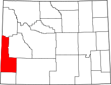 | |
| Towns | ||
| CDPs | ||
| Unincorporated communities | ||
| Footnotes | ‡This populated place also extends into Idaho | |