Hillview-Adeytown
| Adeytown Lee Bight | |
|---|---|
| Unincorporated community | |
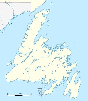 Adeytown Location of Aaron Arm in Newfoundland | |
| Coordinates: 48°04′26″N 53°56′00″W / 48.07389°N 53.93333°W | |
| Country |
|
| Province |
|
| Settled | 1850s |
| Population (2006) | |
| • Total | 307 |
| Time zone | Newfoundland Time (UTC-3:30) |
| • Summer (DST) | Newfoundland Daylight (UTC-2:30) |
| Area code(s) | 709 |
'Adeytown is a designated place located on the Northwest Arm of Trinity Bay, just south of Clarenville in Newfoundland, Canada. It consists of the unincorporated community of Adeytown, and had a population of 307 in the Canada 2006 Census.
Adeytown (formerly called Lee Bight), like Deep Bight, Piston Mere, Maggoty Cove and Forster's, was founded in the 1850s and 1860s as a small logging operation and, with the building of the Newfoundland Railway, it grew as the demand for lumber was at a peak.
Geography
Edward and Pasco Adey came to Lee Bight c.1865 from Hant's Harbour with the intention of logging. Lee Bight had all of the natural requirements for a logging operation, a nearby timber stand sufficient to support a water powered sawmill from a nearby fast flowing brook and clear access to the sea to ship the sawn lumber.
History of Adeytown
Around 1865, Edward, Israel, and Pasco Adey came to Lee Bight (later Adeytown), from Hants Harbour with the intention of logging. By 1870 a water powered sawmill had been built, one of several in the Northwest Arm in Trinity Bay at the time. The first (Methodist) school in Lee Bight was reported in 1883 with 16 students taught by a Miss Mary Mayo. Miss. Mayo had split her time at the Lee Bight School and the half at the Deep Bight school nearby.
In the early 20th century Adeytown had closed its Methodist school and shared one with Caplin Cove. By 1911 Adeytown had 2 sawmills and a church along with the school shared with Caplin Cove and about 30 people were living there for the 1911 Census. At the height of its economic boom in 1921 Adeytown had become a full logging town with 7 sawmills operating,[1] also by this time there was 38 residents living in Adeytown.[2]
As of September 13, 1966 the Adeytown Post Office closed and in 1970 the school was closed and students were bussed to Deep Bight for Elementary School and Clarenville for High School.
See also
References
- ↑ Smallwood, Joseph R., and Robert D. W.. Encyclopedia of Newfoundland and Labrador. St. John's, Newfoundland And Labrador, Canada: Newfoundland Book Publishers (1967), 1981. Print. Retrieved 05/26/2011
- ↑ Census. "Adeyton 1921 Census." 1921 Census of Newfoundland. St. John's, Newfoundland: 1921. 287-288. Newfoundland Grand Banks. Web. 26 May 2011. <http://ngb.chebucto.org/C1921/21-adeyton-tb.shtml>.
Coordinates: 48°04′26″N 53°56′00″W / 48.07389°N 53.93333°W