Addlestone
| Addlestone | |
 St. Paul's Church, Addlestone |
|
 The Crouch Oak |
|
 Addlestone |
|
| Area | 4.87 km2 (1.88 sq mi) |
|---|---|
| Population | 11,501 (Addlestone North and Addlestone Bourneside electoral wards)[1](For the avoidance of doubt these figures exclude Row Town, New Haw and Woodham in the post town) |
| – density | 2,362/km2 (6,120/sq mi) |
| OS grid reference | TQ052644 |
| – London | 18.6 miles (29.9 km) |
| District | Runnymede |
| Shire county | Surrey |
| Region | South East |
| Country | England |
| Sovereign state | United Kingdom |
| Post town | Addlestone |
| Postcode district | KT15 |
| Dialling code | 01932 |
| Police | Surrey |
| Fire | Surrey |
| Ambulance | South East Coast |
| EU Parliament | South East England |
| UK Parliament | Runnymede and Weybridge |
Coordinates: 51°22′10″N 0°29′24″W / 51.3695°N 0.4901°W
Addlestone (/ˈædəlstən/ or /ædəlstoʊn/) is the administrative town of the borough of Runnymede in the county of Surrey, England. The town lies just within the M25 motorway. Addlestone has an ancient oak named The Crouch Oak and is centred 18.6 miles (29.9 km) southwest of London. Junction 11 of the M25 motorway serves the roads local to Addlestone and Chertsey, the adjoining town in which it was historically included. Addlestone has its own railway station on the Chertsey Branch Line, four principal bus services and is home to the post-junior parts of St George's College.
Geography
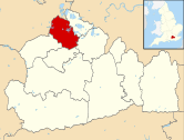
Addlestone is a large village which owing to its size is generally referred to as a town, 18.6 miles (29.9 km) southwest of London and 9.8 miles (15.8 km) north-by-northeast of the county town, Guildford; the town constitutes the administrative centre of the borough of Runnymede of which it is the largest settlement.
Narrow green buffers separate the town of Weybridge and town of Chertsey and a larger green buffer including a farm, M25 and a golf course separates the village of Ottershaw. No fixed southern boundary with New Haw exists which has had signs at various points but not on all approaches[2]
Demography
After the 2001 census the place could only be approximatively interpreted by the county council as home to 16,657 residents in 7,281 homes, whereas neighbouring Chertsey was interpreted as having 11,766 inhabitants, Egham having 11,179 inhabitants (excluding Egham Hythe) and Englefield Green 11,180 inhabitants, leading the statement by the district council that Addlestone is not only the administrative town of Runnymede but also making a case that it is, narrowly, the largest single settlement.[3]
The population of the two wards Addlestone North and Addlestone Bournside was 11,501 in 2011.[1] Populations of associated wards, New Haw and 'Chertsey South and Row Town' (mainly Row Town) were 5,757 and 5,328 respectively. Re-warding is a necessary electoral process to avoid malapportionment and by having more scattered housing estates in the west and south means that those ward towards the close communities of Row Town, Woodham and New Haw are those often redrawn in the borough by the Boundary Commission for England every 8–12 years, as redrawn between 2001 and 2010.[1]
The four wards have their own semi-permanent (land use) profiles: Addlestone Bourneside has the greatest proportion of privately rented homes, Addlestone North that of socially rented homes. Housing in Chertsey South and Row Town which is mostly Row Town was, in 2011, 86% owner-occupied with or without a loan, the third highest proportion in Runnymede. Offices and factories are below the local averages for areas within the M25 – the most common land use being parks, playing fields, flood meadows/woodland, farms and golf courses in the form of Green Belt buffer land mentioned. The M25 motorway accounts for the relatively large proportion of land devoted to roads for the density of population and housing.
| Output area | Homes owned outright | Owned with a loan | Socially rented | Privately rented | Other | km² roads | km² water | km² domestic gardens | km² domestic buildings | km² non-domestic buildings | Usual residents | km² |
|---|---|---|---|---|---|---|---|---|---|---|---|---|
| Addlestone North | 953 | 874 | 366 | 366 | 22 | 0.188 | 0.070 | 0.615 | 0.130 | 0.063 | 5596 | 2.23 |
| Addlestone Bourneside | 738 | 1028 | 318 | 364 | 30 | 0.239 | 0.011 | 0.496 | 0.134 | 0.073 | 5905 | 2.64 |
| Chertsey South and Row Town | 826 | 927 | 140 | 142 | 21 | 0.270 | 0.007 | 0.680 | 0.151 | 0.017 | 5328 | 3.18 |
| New Haw | 753 | 1108 | 204 | 266 | 22 | 0.257 | 0.139 | 0.652 | 0.162 | 0.053 | 5757 | 3.57 |
History
The name Addlestone probably means "Attel's Denu": the valley belonging to a Saxon named Attel.
Addlestone, historically called Atlesdon or Atlesford, was a part of Chertsey ecclesiastical parish[n 1], the basic unit of civil administration.[4]
In 1241 the place was listed as "Attelsdene" and by 1610 John Speed's map shows it as "Adleston", halfway between "St. Annhill" and "St. Georg Hill", just south of the Thames.

The Crouch Oak, an oak tree believed to have originated in the 11th Century, is an important symbol of the town. It used to mark the boundary of Windsor Great Park. Legend says that Queen Elizabeth I stopped by it and had a picnic.[5] The tree is one of the main historic features of the town, and consequently several local businesses use its name in their title. It survived an arson attack in September 2007.
Ongar Hill[n 2], originally a major property now subdivided and in part the motorway, belonged to Vice-Admiral Sir Hyde Parker the elder (d. 1782) noted in the Seven Years' War against Spanish interests in India and the Philippines and the American War of Independence involved with action containing French forces of Martinique.
Sayes Court, Addlestone, now a junior school and residential estate was an old country house, the property of a family named Moore from the 17th to the end of the 18th century. In 1823 it became the property of Sir Charles Wetherell, Recorder (judge) of Bristol, who rebuilt, or at least considerably altered the house.
Chertsey Beomond Manor/Woburn Park
Addlestone, including St George's College's grounds of Woburn Park and the remaining farms and water meadows designated Green Belt were the western strip of Chertsey Manor or Chertsey Beomond Manor (to distinguish it from others), possessed by Chertsey Abbey from the grant of land by Frithwald, subregulus of Surrey, at a date between the years 666 and 675 CE until the Dissolution of the Monasteries.[4]
Adam de Woburn lived at Woburn Park in 1260[6]
Only thirteen years after 1537 the Crown was content to lease the land rather than continue with a steward (office) so Sir William Fitz William (later his widow) held the whole Chertsey Beomond manor from 1550–1574; later[4] Sir Francis Bacon held it for the infant Charles I who granted it specifically for his Queen, Henrietta Maria (of France). During the Commonwealth of England, the government sold the manor to William Aspinall who sold 292 trees of Birch Wood there for the Navy; however taken back by the Crown at the Restoration of the monarchy and the first of many leases was granted; the first lease was to the first Lord Holles. For example, from 1779–1803 the Duke of Bridgwater held it and from an unknown date until 1827 the British Commander-in-Chief Prince Frederick, Duke of York and Albany, famed for the nursery rhyme and the Duke of York Column by St James's Palace and Carlton Terrace was tenant of the lands.[n 3]
In the 1740s, the famed gardener, Philip Southcote, chose to construct a two-storey house. Now a Grade II listed building,[7] it was also named Woburn Park, with an original ornamented farm (ferme ornée) on Woburn Hill with fields for cattle or crops, decorated with statues, grotto, vases, temples, archways and other features, much of which survives as part of St George's College. The subsequent owners of Woburn Park were:[n 4]
- 1783 Lord Petre
- 1816 Vice Admiral Charles Stirling, listed in deeds as Admiral Stirling but Vice-Admiral
- 1834 Lord and Lady King, later Lord (Earl of and Countess of) Lovelace
- 1862 Lord (2nd Earl of) Kilmorey
Since 1800
A Baptist chapel was built in Addlestone in 1872, and a Wesleyan chapel in 1898. Another ecclesiastical district of Addlestone, though today separated now by the residential development of New Haw, called Woodham and closer to the major town of Woking was formed in 1902 on what were the boundaries of Chertsey parish and Horsell parish.[4]
By 1911 the ecclesiastical district and ward Addlestone could be considered to have outstripped the original centre of the parish, Chertsey, in importance. According to the Victoria County History published in that year:
This ward contains the largest number of people of the three wards [Chertsey, Addlestone, and Outer Ward] into which the Chertsey Urban District was divided, and the number of new houses shows the growing character of the neighbourhood.[4]
Chertsey poor law union's workhouse was in Addlestone and was built in 1836–8. Addlestone chapel was added in 1868. The Village Hall was built in 1887 by the Addlestone Village Hall Company. The Princess Mary Village Homes at Addlestone were established by the organisation and patronage of the Duchess of Teck (Princess Mary of Cambridge) in 1871: certified industrial schools for female children of prisoners, or children otherwise in a destitute or dangerous position. They were conducted on the separate homes system, and are supported by voluntary contributions, with a Treasury allowance for children committed under the Industrial Schools Act. Addlestone's schools were mostly founded in this period: St. Paul's Primary School, built 1841, enlarged 1851 and 1885, initially for girls and infants. Chertsey Urban District took over all roles of the parish and of the "Godley Hundred" under the Local Government Act 1894. A boys' school was added in 1901. New Ham School was built in 1874. St. Augustine's School (Church) for infants was built in 1882, and Chapel Park (a church-sponsored School) in 1896.[4]
On Station Road, a large Blériot aircraft factory was built in 1917. The several hundred aeroplanes produced there were taken by road to Brooklands for final assembly and test flying.[8] In the 1950s the site was taken over by Weymann to build buses and coaches who built the prototype of the Routemaster bus before ceasing trade in the mid-1960s. After that, part of the site was used by Caddy's who built taxis. In early 1967, Plessey moved from Chessington and took over this factory. In 1990, the site was used by Marconi. All these companies were important local employers. By 2000 the site was derelict and has since been cleared and redeveloped as a business park called Aviator Park (http://www.aviator-addlestone.co.uk/), the name referring to its original use.[8]
Elevation, soil and geology

Elevations range between 11 metres (36 ft) and 40 metres (130 ft). The maximum is on Row Hill recreation ground, Row Town, Addlestone; a ridge that continues to the northwest of Row Town where it is known as Ongar/Spinney Hill, where Great Grove Farm in its centre also reaches this height; the minimum is by the Thames and along the Woburn Park Stream which is the main distributary of The Bourne the main waterway of the village, a stream rising as the Windle Brook in Windlesham cutting a shallow ravine, flowing past the McLaren Technology Centre and Woodham then passing to the east of the village.[2]
Eminences of the Bagshot Sand stand out above the river most notably the western hills mentioned and Woburn Hill which is 25 metres (82 ft) AOD compared to St Ann's Hill, Chertsey's 61 metres (200 ft), however, is part of the landscape critical to Woburn Park and the private gardens of Woburn Hill.[2][4]
Major climate changes in Britain causing sea level changes in the last 2.58 million years, with mini Ice Ages, the ice sheets did not extend to Surrey but sand and gravel deposits swept towards the fledgling River Thames were spread in all lower parts. Gravel terraces at various heights on the valley sides are the remnants of successive floodplains, the highest terrace being the oldest and the lowest the youngest. The most prominent terraces mark the former levels of the Thames in north Surrey. Along tributary slopes, a deposit, head, forms the main sediment of latest age. Head comprises angular pieces of rock and soil derived locally from the extensive frost-shattering of rocks and the subsequent movement of this material down valley slopes.[9]
Soil is predominantly "loamy soil with naturally high groundwater".[10] Woburn Hill has "slowly permeable seasonally wet slightly acid but base-rich loamy and clayey soil". New Haw, the southern part of the Addlestone post town and historically a part has "freely draining slightly acid loamy soils"; so does Great Grove Farm.[10] West of the M25 as far as the centre of Ottershaw is a belt of "slightly acid loamy and clayey soils with impeded drainage" soil.[10]
Education
There are two secondary schools in Addlestone: Jubilee High School, state-funded and St George's College, independently funded which relocated from Croydon to Woburn Park in 1884.[4] All non-junior parts of the school occupy Woburn Park, Addlestone described above.[11]
A range of primary and infant schools are in Addlestone which include St Paul's C of E Primary School, Ongar Place, Sayes Court, The Holy Family Catholic Primary School and Darley Dene infant school. A few nurseries also serve the wider-area community.
Landmarks
The George Inn
Heading north from the town, towards the Addlestonemoor five-way, two-lane roundabout is a Grade II listed building at the renaming Brighton Road to Chertsey Road, the George Inn,[12] almost opposite which are another listed building split into two houses: nos 114–116 Chertsey Road, early 19th century, slate-roofed houses with sash windows.[13] This Inn is a Tudor Period building with 18th century and later alterations and has three gables facing the road.[12]
Woburn Hill
Woburn Hill is a large house built in 1815 spread over three storeys, that features a moulded cornice and fluted Greek Doric columns to its porch with an iron balustrade above it forming a balcony in front of a central window of the floor above.[4][14]
Localities

Rowhill or Row Hill
Row Hill forms a residential estate with shops of a butcher, baker and electrical appliance store that is contiguous with Addlestone to its west.[15] These shops are on Ongar Hill not Row Hill and hence the name Ongar Parade, also known locally as "Top shops" due to being at the top of Row Town.
Addlestone Moor
Addlestone Moor has a public house, now closed 08/2013, now a Day Nursery, flood meadows, a sports pitch and a mobile home park.[2] Its roundabout marks on the closer side of town has five exits and is used for motorway access from primarily Addlestone, Weybridge, Shepperton, Laleham and Chertsey.
Sport
Abbey Rangers play at Addlestone Moor, on the Thames winter flood meadows (prior to the construction of the Thames Barrier) next to the disused Woburn Arms and the athletics track in Woburn Park which is now St George's RC College.
The now-defunct Addlestone & Weybridge Town were established as Addlestone Town in 1885 and played at their ground in Liberty Lane until their dissolution in 1985. There is now housing on the site of the club's ground.[16]
Addlestone Victory Park Bowls Club was formed in 1931 and has played at the facilities maintained by Runnymede Borough Council since then. The club offers both indoor and outdoor short mat bowling facilities to members of all ages and levels of experience.
Economy, culture and community
Addlestone is mentioned in H.G Wells' book The War of the Worlds, in which the second of ten Martian invasion ships (called 'cylinders') lands at the Addlestone Golf Links. This is probably a reference to New Zealand Golf Club (founded 1895) on Woodham Lane - the road from Woking to Addlestone - and not the Abbey Moor Golf Course which was only established in 1989.
Addlestone Library is co-located with Runnymede Borough Council and Addlestone Police in the Runnymede Civic Centre built in 2008 at a cost of £12,700,000 with atriums and courtyards on Station Road and opposite Addlestone Health Centre.[17]
Its main road is Station Road which has many shops, two supermarkets, Addlestone Methodist Church, a doctors' NHS surgery, the Aviator business park and the Eileen Tozer Day Centre; the civic centre of Runnymede borough council is on this street.[18]
Station Road hosts a 2011-completed business (office) estate, Aviator Park, in glass and steel which has landscaped verges with trees, shrubs and grass.[19]
In July 2015, Bouygues Development[20] commenced work on a new, large scale town centre regeneration called, "Addlestone ONE". Located along Station Road and next to Runnymede Civic Centre, when complete in 2017, the project will create 213 new homes, a Premier Inn hotel, a Waitrose supermarket, a premium 6-screen cinema operated by The Light Cinemas, new public spaces, various restaurants and shops as well as a multi-storey car park. The Ground Breaking Ceremony for the development took place on 23 October 2015 and was officiated by Foreign Secretary, the Rt. Hon. Philip Hammond.
The UK headquarters of multinational defence company Thales Group is located in the town.[21]
Transport

Road
Station Road joins into surrounding A-roads in all directions, including non-principal "Brighton Road" which has since become superseded by the motorway network and other north-south roads, the A319 that links in towards routes to Berkshire and the A320 road that is convenient for closer areas of Thames Valley corridor, and the A318 to Brooklands with its museum, luxury hotel and retail park and the A3 road Painshill interchange between Hersham and Cobham towards London.
Rail
Addlestone railway station is on the Chertsey Branch Line from Weybridge from where rapid national services can be caught on the South West Main Line. A journey time of 47 minutes to London Waterloo station with one change is achievable or 81 minutes with no changes via Staines upon Thames, Feltham, Hounslow, Chiswick and Putney.[22]
Buses
Addlestone has four principal bus services. An hourly service to Slough via Staines upon Thames and Windsor and in the other direction to the Brooklands retail park operates: bus 51:[23]
Other services with more than one bus per hour are buses 446 and 459 to Kingston upon Thames and bus 446 between Woking and Staines upon Thames.[24]
River navigation
The Wey Navigation canal runs to the south east of the town. Coxes lock is the deepest unmanned lock on the Navigation with a fall of 8 feet 6 inches (2.59 m).
Nearest settlements
 |
across The Chertsey Bourne Chertsey |
across Chertsey Meads SSSI and the River Thames Shepperton |
across the Weybridge Islands and the River Thames Shepperton |
|
| Ottershaw | |
Weybridge | ||
| ||||
| | ||||
| across a belt of farms Woodham |
across Crockford Bridge Farm and Moated Farm New Haw |
across The Bourne and The River Wey Weybridge and Brooklands |
Notes and references
- Notes
- ↑ This division was simply called a parish before coming of civil parishes the 19th century
- ↑ Per Malden: in 1911 the "seat of" Henry Cobbett, in 1911.
- ↑ In 1828 £3,330 was paid for the "manor [title] and other crown lands" finally being divided into auction lots on the bankruptcy of James Goren in 1834.[4]
- ↑ Woburn Park's actual park as mentioned forms the grounds of St George's College, open by appointment and on visitor days and is separately Grade II listed: Historic England. "Details from listed building database (1260104)". National Heritage List for England. Retrieved 13 November 2012.
- References
- 1 2 3 4 Key Statistics; Quick Statistics: Population Density United Kingdom Census 2011 Office for National Statistics Retrieved 31 October 2014
- 1 2 3 4 Ordnance Survey map, courtesy of English Heritage
- ↑ Surrey County Council collated census statistics, major settlements
- 1 2 3 4 5 6 7 8 9 10 H.E. Malden (editor) (1911). "Parishes: Chertsey". A History of the County of Surrey: Volume 3. Institute of Historical Research. Retrieved 13 November 2012.
- ↑ Addlestone Tourist Information
- ↑ Philip Southcote School about the grounds shared with the College
- ↑ Woburn Park (house) Historic England. "Details from listed building database (1372053)". National Heritage List for England. Retrieved 13 November 2012.
- 1 2 Addlestone Historical Society
- ↑ Natural England – Geodiversity
- 1 2 3 Cranfield University National Soil Resources Institute
- ↑ St George's College
- 1 2 The George Inn Historic England. "Details from listed building database (1029175)". National Heritage List for England. Retrieved 13 November 2012.
- ↑ 114–116 Chertsey Road Historic England. "Details from listed building database (1029176)". National Heritage List for England. Retrieved 13 November 2012.
- ↑ Woburn Hill Historic England. "Details from listed building database (1372053)". National Heritage List for England. Retrieved 13 November 2012.
- ↑ File:Rowhill shops - butcher, baker, electrical appliance centre - geograph.org.uk - 171643.jpg
- ↑ Official match programme for the last ever AWTFC game – Sat 27 April 1985.
- ↑ Runnymede Civic Offices - fcbstudios.com FeildenCleggBradleyStudios (architects), Gallery - 'Runnymede Civic Centre in brief, selected awards and drawings', 2008.
- ↑ Runnymede B.C. website
- ↑ Aviator Park
- ↑ Bouygues Development website
- ↑ Thales Group – Addresses
- ↑ Association of Train Operating Companies official timetable
- ↑ http://www.firstgroup.com/ukbus/berkshire_thames/journey_planning/timetables/index.php?operator=1&page=1&redirect=no
- ↑ Surrey County Council travel information
External links
| Towns, villages and neighbourhoods |
|  | ||||||||||||||
|---|---|---|---|---|---|---|---|---|---|---|---|---|---|---|---|---|
| Notable parks | ||||||||||||||||
| Churches | ||||||||||||||||
| Education | ||||||||||||||||
| Transport |
| |||||||||||||||
| Buildings and structures | ||||||||||||||||
| Sports |
| |||||||||||||||
Places listed are articles notable as settlements, arranged by post town | ||||||||||||||||