Acushnet Cedar Swamp
| Acushnet Cedar Swamp | |
|---|---|
|
Acushnet Cedar Swamp | |
 Map of Massachusetts | |
| Location | Bristol County, Massachusetts |
| Nearest city | New Bedford |
| Coordinates | 41°41′32″N 70°57′35″W / 41.69222°N 70.95972°WCoordinates: 41°41′32″N 70°57′35″W / 41.69222°N 70.95972°W |
| Area | 1,100 acres (450 ha) |
| Designated | 1972 |
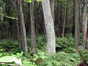
Acushnet Cedar Swamp is a 1,100-acre (450 ha) swamp located in Bristol County, Massachusetts. It is managed by the Massachusetts Department of Environmental Protection.[1] It was designated a National Natural Landmark by the National Park Service in June 1972.[2] The New Bedford Regional Airport borders the swamp to the south.
One of the State's largest, wildest and most impenetrable swamps, and an outstanding example of the diversity of conditions and species in the glaciated section of the oak-chestnut forest.[2]
See also
- List of National Natural Landmarks in Massachusetts
- List of Massachusetts State Parks
- List of old growth forests in Massachusetts
References
- ↑ "Town of Dartmouth, Priority Development and Protection Areas" (PDF). Southeast Regional Planning and Economic Development District. September 2008. p. 11. Retrieved 2013-03-12.
- 1 2 "Acushnet Cedar Swamp National Natural Landmark". National Park Service. US Gov. Archived from the original on 7 May 2009. Retrieved 2009-05-17.
This article is issued from Wikipedia - version of the 11/18/2016. The text is available under the Creative Commons Attribution/Share Alike but additional terms may apply for the media files.