Acsa
| Acsa | ||
|---|---|---|
| ||
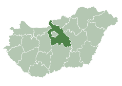
 Acsa Location of Acsa in Hungary | ||
| Coordinates: 47°47′49.45″N 19°22′53.54″E / 47.7970694°N 19.3815389°E | ||
| Country | Hungary | |
| Region | Central Hungary | |
| County | Pest | |
| Subregion | Váci | |
| Rank | Village | |
| KSH code | 18573[1] | |
| Government | ||
| • Mayor | Rezső Szekeres[2] | |
| Area[3] | ||
| • Total | 26.94 km2 (10.40 sq mi) | |
| Population (1 January 2008)[4] | ||
| • Total | 1,528 | |
| • Density | 57/km2 (150/sq mi) | |
| Time zone | CET (UTC+1) | |
| • Summer (DST) | CEST (UTC+2) | |
| Postal code | 2683 | |
| Area code | +36 27 | |
| Website | www.acsa.hu/index.php | |

Acsa is a village in Pest County, Hungary.
Location
The village lies at the foot of the Cserhát hills by the upper River Galga in Pest County, near the border with Nógrád County.
Population
Most of Acsa's population is Slovakian.
Communications
Route 2108 serves the village by road from Aszód and Balassagyarmat. Stopping trains of the Hungarian State Railways serve the village on line 78 (Aszód–Balassagyarmat–Ipolytarnóc). Acsa and Erdőkürt share a station ("Acsa-Erdőkürt"), between Püspökhatvan and Galgaguta.
History
The first known mention of the village as "Acha" was in 1341. At that time the village was owned by the Achai family and from 1422 it was the Palatine Miklós Garai's property. During Turkish rule (see Ottoman Hungary) the village was demolished, but later on Slovakians settled. From 1730 the village was the Prónay family's land.
Landmarks

- The baroque Prónay castle, which was built around 1775 by Giovanni Battista Carlone (it is in Acsaújlak, but is not open to visitors)
- The ruins of Csővár to the north
- The Roman Catholic church, built in 1747
- The village museum
Famous people
Sándor Prónay, knight and chamberlain, was born in Acsa in 1760.
References
- ↑ Acsa at the Hungarian Central Statistical Office (Hungarian).
- ↑ "Közérdekű információk -> hivatalok" [Public information -> Mayors' offices] (in Hungarian). cegexpo.hu. Retrieved 23 September 2009.
- ↑ Acsa at the Hungarian Central Statistical Office (Hungarian).
- ↑ Acsa at the Hungarian Central Statistical Office (Hungarian). 1 January 2008
External links
- Welcoming (Vendégváró) (Hungarian)
- Photos (Légifotók Acsáról) (Hungarian)
- Acsa, village at Cserhát foot (Acsa, falu a Cserhát lábánál) (Hungarian)
- Acsa (Hungarian)
- Acsa Evangelical Congregation (Acsai Evangélikus Egyházközség) (Hungarian)