Achladokampos
| Achladokampos Αχλαδόκαμπος | |
|---|---|
 Achladokampos | |
|
Location within the regional unit 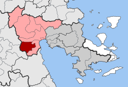 | |
| Coordinates: 37°31′N 22°35′E / 37.517°N 22.583°ECoordinates: 37°31′N 22°35′E / 37.517°N 22.583°E | |
| Country | Greece |
| Administrative region | Peloponnese |
| Regional unit | Argolis |
| Municipality | Argos-Mykines |
| • Municipal unit | 105.9 km2 (40.9 sq mi) |
| Population (2011)[1] | |
| • Municipal unit | 497 |
| • Municipal unit density | 4.7/km2 (12/sq mi) |
| Time zone | EET (UTC+2) |
| • Summer (DST) | EEST (UTC+3) |
| Vehicle registration | AP |
Achladokampos (Greek: Αχλαδόκαμπος) is a village and a former community in Argolis, Peloponnese, Greece. Since the 2011 local government reform it is part of the municipality Argos-Mykines, of which it is a municipal unit.[2] The municipal unit has an area of 105.883 km2.[3] Population 497 (2011). It is located on a mountainside approximately midway between Argos and Tripoli (~30 km from each) at an elevation of approximately 450 meters.
The community has, through a project with the Ministry of Development and EEN Hellas SA (a subsidiary of the French energy holding company EDF Energies Nouvelles), installed 10 Vestas V90-3MW wind turbines on the mountain above the village.
A significant number of emigrants from Achladokampos have settled in the United States since the early 20th century and have formed the Brotherhood of Achladokambiton as a means of keeping in touch.
References
- ↑ "Απογραφή Πληθυσμού - Κατοικιών 2011. ΜΟΝΙΜΟΣ Πληθυσμός" (in Greek). Hellenic Statistical Authority.
- ↑ Kallikratis law Greece Ministry of Interior (Greek)
- ↑ "Population & housing census 2001 (incl. area and average elevation)" (PDF) (in Greek). National Statistical Service of Greece.