Achintee, Fort William
| Achintee | |
| Scottish Gaelic: Achadh an t-Suidhe | |
 Looking down the mountain path to the Ben Nevis Inn |
|
 Achintee |
|
| OS grid reference | NN125730 |
|---|---|
| Council area | Highland |
| Country | Scotland |
| Sovereign state | United Kingdom |
| Postcode district | PH33 6 |
| Police | Scottish |
| Fire | Scottish |
| Ambulance | Scottish |
| EU Parliament | Scotland |
| UK Parliament | Ross, Skye and Lochaber |
| Scottish Parliament | Skye, Lochaber and Badenoch |
Coordinates: 56°48′38″N 5°04′18″W / 56.81056°N 5.07166°W
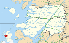
Achintee (Scottish Gaelic: Achadh an t-Suidhe) is a location in Glen Nevis in the Highland council area of Scotland. It is around 2 km south-east of Fort William and just to the east of the River Nevis.[1]
Achintee is the starting point for the "Mountain Path", the most popular route up Ben Nevis. The Ben Nevis Inn is within Achintee, at the end of a minor road.
The name Achintee is from the Gaelic for "the field of the seat".
References
This article is issued from Wikipedia - version of the 6/28/2016. The text is available under the Creative Commons Attribution/Share Alike but additional terms may apply for the media files.