Acher
For the Jewish heretic, see Elisha ben Abuyah.
| Acher | |
|---|---|
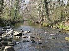 Acher at Oberachern | |
| Country | Germany |
| Basin | |
| Main source |
Black Forest 1,054 m (3,458 ft) |
| River mouth |
Rhine 48°45′27″N 8°0′17″E / 48.75750°N 8.00472°ECoordinates: 48°45′27″N 8°0′17″E / 48.75750°N 8.00472°E |
| Physical characteristics | |
| Length | 53 km (33 mi) |
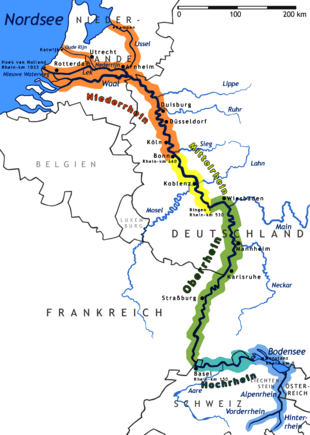
The Acher is a river in the district of Ortenau, Baden-Württemberg, Germany and a right tributary of the Rhine River. It flows in an eastwesterly direction from the Black Forest toward the Rhine, between the Rench River to the South and the Oos River to the North.
Its source is located near the top of Schliffkopf Mountain (Black Forest) at an elevation of 1,054 metres (3,458 ft) above sea level, above Ottenhöfen. From there it runs through the Acher Valley until it enters the Upper Rhine River Plains near Achern and flows into the Rhine near Lichtenau.
External links
References
Much of the content of this article comes from the equivalent German-language Wikipedia article (retrieved January 25, 2006).
- Britannica Atlas
Tributaries of the Rhine | ||
|---|---|---|
| Left (western) |
|  |
| Right (eastern) |
| |
This article is issued from Wikipedia - version of the 6/15/2016. The text is available under the Creative Commons Attribution/Share Alike but additional terms may apply for the media files.