Abu Qilqil
| Abu Qilqil أبو قلقل | |
|---|---|
| Town | |
 Abu Qilqil Location of Abu Qilqil in Syria | |
| Coordinates: 36°26′09″N 38°05′35″E / 36.4358°N 38.0931°ECoordinates: 36°26′09″N 38°05′35″E / 36.4358°N 38.0931°E | |
| Country |
|
| Governorate | Aleppo |
| District | Manbij |
| Subdistrict | Abu Qilqil |
| Population (2004)[1] | 2,742 |
| Time zone | EET (UTC+2) |
| • Summer (DST) | EEST (UTC+3) |
| Geocode | C1798 |
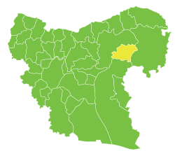
Abu Qilqil is the administrative center of Nahiya Abu Qilqil of the Manbij District.
Abu Qilqil (Arabic: أبو قلقل, also transliterated Abu Qalqal) is a town in the northeastern Aleppo Governorate, northwestern Syria. The village is located some 10 km (6.2 mi) to the northwest of the Tishreen Dam on the Tishreen Plain, part of the larger Manbij Plain. Nearby localities include district center Manbij 16 km (9.9 mi) to the northwest. In the 2004 census, it had a population of 2,742.[1]
References
- 1 2 "2004 Census Data for Nahiya Abu Qilqil" (in Arabic). Syrian Central Bureau of Statistics. Retrieved 15 October 2015. Also available in English: UN OCHA. "2004 Census Data". Humanitarian Data Exchange. Retrieved 4 December 2015.
Capital: Aleppo | ||||||||
|  | |||||||
|
| ||||||||
| ||||||||
| ||||||||
| ||||||||
| ||||||||
This article is issued from Wikipedia - version of the 10/21/2016. The text is available under the Creative Commons Attribution/Share Alike but additional terms may apply for the media files.