Abu Hamad
| Abu Hamad | |
|---|---|
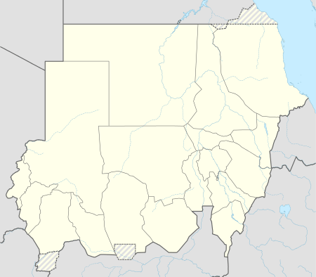 Abu Hamad Location in Sudan | |
| Coordinates: 19°32′36″N 33°20′16″E / 19.54333°N 33.33778°E | |
| Country |
|
| Admin. division | River Nile State |
Abu Hamad (Arabic: أبو حمد), also spelt 'Abu Hamed', is a town of Sudan on the right bank of the Nile, 345 mi by rail north of Khartoum. It stands at the centre of the great S-shaped bend of the Nile, and from it the railway to Wadi Halfa strikes straight across the Nubian Desert, a little west of the old caravan route to Korosko. A branch railway, 138 mi long, from Abu Hamad goes down the right bank of the Nile to Karima in the Dongola mudiria.[1]
The town is named after a celebrated sheikh buried here, by whose tomb travellers crossing the desert used formerly to deposit all superfluous goods, the sanctity of the saint's tomb ensuring their safety.[1]
Climate
Abu Hamad has a hot desert climate (Köppen climate classification BWh).
| Climate data for Abu Hamad (1961–1990, extremes 1909–present) | |||||||||||||
|---|---|---|---|---|---|---|---|---|---|---|---|---|---|
| Month | Jan | Feb | Mar | Apr | May | Jun | Jul | Aug | Sep | Oct | Nov | Dec | Year |
| Record high °C (°F) | 38.0 (100.4) |
41.2 (106.2) |
44.4 (111.9) |
47.0 (116.6) |
48.0 (118.4) |
49.0 (120.2) |
49.5 (121.1) |
47.7 (117.9) |
47.0 (116.6) |
45.0 (113) |
40.0 (104) |
38.9 (102) |
49.5 (121.1) |
| Average high °C (°F) | 28.1 (82.6) |
30.4 (86.7) |
34.6 (94.3) |
38.7 (101.7) |
41.9 (107.4) |
43.5 (110.3) |
42.1 (107.8) |
41.7 (107.1) |
42.4 (108.3) |
39.2 (102.6) |
33.3 (91.9) |
29.4 (84.9) |
37.1 (98.8) |
| Daily mean °C (°F) | 20.3 (68.5) |
22.9 (73.2) |
25.9 (78.6) |
29.9 (85.8) |
33.5 (92.3) |
35.3 (95.5) |
34.5 (94.1) |
34.5 (94.1) |
34.9 (94.8) |
31.5 (88.7) |
26.1 (79) |
21.9 (71.4) |
29.3 (84.7) |
| Average low °C (°F) | 12.5 (54.5) |
13.8 (56.8) |
17.3 (63.1) |
21.0 (69.8) |
25.0 (77) |
27.2 (81) |
26.9 (80.4) |
27.2 (81) |
27.3 (81.1) |
23.7 (74.7) |
18.9 (66) |
14.4 (57.9) |
21.3 (70.3) |
| Record low °C (°F) | 4.5 (40.1) |
5.3 (41.5) |
7.8 (46) |
11.8 (53.2) |
12.7 (54.9) |
20.0 (68) |
20.0 (68) |
20.0 (68) |
18.9 (66) |
13.8 (56.8) |
7.5 (45.5) |
5.3 (41.5) |
4.5 (40.1) |
| Average precipitation mm (inches) | 0.2 (0.008) |
0.0 (0) |
0.0 (0) |
0.1 (0.004) |
0.2 (0.008) |
0.1 (0.004) |
5.1 (0.201) |
6.0 (0.236) |
0.7 (0.028) |
0.1 (0.004) |
0.1 (0.004) |
0.0 (0) |
12.6 (0.496) |
| Average precipitation days (≥ 0.1 mm) | 0.1 | 0.0 | 0.0 | 0.1 | 0.2 | 0.0 | 0.6 | 0.8 | 0.4 | 0.0 | 0.0 | 0.0 | 2.2 |
| Average relative humidity (%) | 31 | 24 | 19 | 17 | 16 | 15 | 20 | 25 | 20 | 22 | 31 | 33 | 23 |
| Mean monthly sunshine hours | 313.1 | 291.2 | 316.2 | 324.0 | 341.0 | 324.0 | 325.5 | 322.4 | 270.0 | 313.1 | 309.0 | 313.1 | 3,762.6 |
| Percent possible sunshine | 90 | 90 | 84 | 85 | 83 | 81 | 80 | 81 | 74 | 86 | 92 | 91 | 85 |
| Source #1: NOAA[2] | |||||||||||||
| Source #2: Meteo Climat (record highs and lows)[3] | |||||||||||||
References
- 1 2
 One or more of the preceding sentences incorporates text from a publication now in the public domain: Chisholm, Hugh, ed. (1911). "Abu Hamed". Encyclopædia Britannica. 1 (11th ed.). Cambridge University Press. p. 78.
 - ↑ "Abu Hamed Climate Normals 1961–1990". National Oceanic and Atmospheric Administration. Retrieved April 23, 2015.
- ↑ "Station Abu Hamad" (in French). Meteo Climat. Retrieved 22 October 2016.
- Attribution
- This article incorporates text from a publication now in the public domain: Chisholm, Hugh, ed. (1911). "Abu Hamed". Encyclopædia Britannica (11th ed.). Cambridge University Press.
Coordinates: 19°32′36″N 33°20′16″E / 19.54333°N 33.33778°E