Aba, Okayama
| Aba 阿波村 | |
|---|---|
| Former municipality | |
|
Former Aba village hall | |
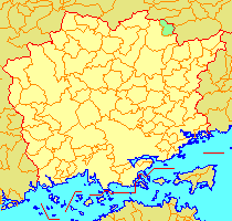 Location of Aba in Okayama Prefecture | |
 Aba Location in Japan | |
| Coordinates: 35°14′13.45″N 134°6′45.2″E / 35.2370694°N 134.112556°ECoordinates: 35°14′13.45″N 134°6′45.2″E / 35.2370694°N 134.112556°E | |
| Country | Japan |
| Region | Chūgoku |
| Prefecture | Okayama Prefecture |
| District | Tomata |
| Merged |
February 28, 2005 (now part of Tsuyama) |
| Area | |
| • Total | 42.07 km2 (16.24 sq mi) |
| Population (2003) | |
| • Total | 669 |
| • Density | 15.90/km2 (41.2/sq mi) |
| Symbols | |
| • Tree | Cryptomeria |
| • Flower | Magnolia kobus |
| • Bird | Japanese bush-warbler |
| Time zone | Japan Standard Time (UTC+9) |

Aba (阿波村 Aba-son) was a village located in the north of Tomata District, Okayama Prefecture, Japan, sharing a border with Tottori Prefecture.
As of 2003, the village had an estimated population of 669 and a population density of 15.90 persons per km2. The total area was 42.07 km2.
On February 28, 2005, Aba, along with the town of Kamo (also from Tomata District), the town of Shōboku (from Katsuta District), and the town of Kume (from Kume District), was merged into the expanded city of Tsuyama and no longer exists as an independent municipality.
Most of Aba's area is forest and/or mountains, and its major industries are agriculture and forestry. It has been affected by rural depopulation, leaving it with the smallest population in the prefecture.
Geography
Adjoining municipalities
Education
There are two schools in Aba:
- Aba Primary School
- Kamo Middle School (an integrated primary-middle school)
Transportation
Road
Notable places and events
- Nondaki Fall