Along, Arunachal Pradesh
| Aalo Aalo | |
|---|---|
| District HQ | |
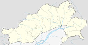 Aalo  Aalo Location in Arunachal Pradesh, India | |
| Coordinates: 28°10′N 94°46′E / 28.17°N 94.77°ECoordinates: 28°10′N 94°46′E / 28.17°N 94.77°E | |
| Country |
|
| State | Arunachal Pradesh |
| District | West Siang |
| Government | |
| • Type | Multi Party democracy |
| • Deputy Commissioner | Shri Pige Ligu , IAS |
| Elevation | 619 m (2,031 ft) |
| Population (2011)[1] | |
| • Total | 20,680 |
| • Rank | 4 (in AP) |
| • Density | 13/km2 (30/sq mi) |
| Languages | |
| • Official | English |
| Time zone | IST (UTC+5:30) |
| PIN | 791 001 |
| Telephone code | 91 3783 XXX XXXX |
| Vehicle registration | AR-08 |
| Climate | Cfa (Köppen) |
| Precipitation | 2,477 millimetres (97.5 in) |
| Avg. Annual Maximum Temperature | 28.1 °C (82.6 °F) |
| Avg. Annual Minimum Temperature | 15.3 °C (59.5 °F) |
| Avg. Winer Temperature | 18.5 °C (65.3 °F) |
| Avg. Summer Temperature | 24.7 °C (76.5 °F) |
| Website |
westsiang |
'Aalo' is a census town and headquarter of the West Siang district of the Indian state of Arunachal Pradesh. Its old name is 'Along'. It is located about a days drive 220 kilometres (140 mi) from Likabali which is at the border of Assam and Arunachal Pradesh.
Culture
Mopin is the main festival which runs from 5 April to 6 April. The Yomgo River Festival, held every year during peak tourist season, and lasting 3–4 days, is celebrated from 11 January to 15 January. This festival is celebrated with a view to promote tourism, indigenous culture and tradition, handloom & handicrafts and showcase its rich cultural heritage.
Demographics
As of 2001,[2] Along had a population of 16,834. Males constitute 56% of the population and females 44%. Aalo has an average literacy rate of 69%, higher than the national average of 59.5%; with 75% of the males and 61% of females literate. 15% of the population is under 6 years of age. The low sex ratio – 916 girls for every 1000 boys in 2001 – is cause for concern, even though it is not typical of the region.
In 2011, its population was 20,700.[1] The majority of Aalo's population consists of Galo people and Galo is the main languages. The major religion is Donyi-Polo, followed by Christianity and small minorities of followers of Tibetan Buddhism, Hinduism and Islam.
Connectivity
Aalo has a good road network and the road which runs from north Lakhimpur to the capital city of Itanagar, connects the town of Aalo to the city. Regular bus services to Aalo run from Itanagar. Arunachal Pradesh State Transport Service (APSTS) buses are available to and from Aalo. There is a 5 hours journey by bus from Pasighat to Aalo (106 km) while from Moying (150 km) the bus will take around 6.5 hours to reach Aalo.
The nearest airport to Aalo is at Likabali, which is situated in the state of Assam. Likabali is connected by flight services to Guwahati and Dibrugarh. One can take a bus or hire a taxi from Likabali to Aalo.
Aalo has no railway and the nearest railway station is at Silapathar. A new line which connects Aalo to Silapathar through broadgauge railway was proposed and the survey has already been completed and forwarded to the railway board.[3]
Media
Along has an All India Radio Relay station known as Akashvani Along. It broadcasts on FM frequencies.
References
- 1 2 "Aalo Population Census 2011". Government of India. Retrieved 10 August 2016.
- ↑ "Census of India 2001: Data from the 2001 Census, including cities, villages and towns (Provisional)". Census Commission of India. Archived from the original on 2004-06-16. Retrieved 2008-11-01.
- ↑ "Govt plans 3 key railway lines". The Indian Express. Retrieved 4 Aug 2011.
| Western Air Command |  | |
|---|---|---|
| Eastern Air Command | ||
| Central Air Command | ||
| Southern Air Command | ||
| South Western Air Command | ||
| Training Command | ||
| Maintenance Command | ||
| Advanced Landing Grounds (ALGs) | ||
All bases and landing grounds are suffixed with AFS and ALG which means Air Force Station and Advanced Landing Ground respectively. Examples: Pathankot AFS, Fukche ALG | ||