A4118 road
| |
|---|---|
 | |
| Route information | |
| Length: | 17 mi (27 km) |
| Major junctions | |
| Southwest end: | Greenhill, Swansea |
|
| |
| Northeast end: | Port Eynon, Swansea |
| Road network | |

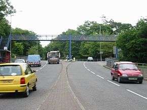
The A4118 road is a road in Swansea, Wales which connects Dyfatty Street in the city centre with the village of Port Eynon at the end of the Gower Peninsula. It runs in an approximate east-west direction. Beginning from the city centre, the route runs though suburban areas until it reaches Upper Killay where the road enters rural Gower. It passes over Fairwood Common and through several villages before terminating at Port Eynon.
The route
The A4118 starts at Dyfatty Street in Swansea city centre at the junction with the A483 Carmarthen Road, which is just north of Swansea railway station. It then goes westwards through the town centre parallel with the A4067 road coastal road to Mumbles. It passes through Mount Pleasant and Uplands before reaching Sketty, where having passed the parish church of St Pauls and Holy Trinity, it crosses the A4216, a road linking junction 47 of the M4 motorway with the coast near Mumbles.[1]

After passing through Killay and Upper Killay, where the B4271 road branches off to the right, the A4118 turns towards the southwest and leaves the main urban area of Swansea and the scenery becomes more rural. The road crosses Fairwood Common, where Swansea Airport can be seen on the right, and after turning westward the road becomes more scenic with Pennard Castle and the links course of Pennard Golf Club visible to the left. It then passes through the villages of Parkmill, Penmaen and Knelston. Here the road swings round to the south and passes through the village of Llandewi. The short B4247 road to Rhossilli branches off to the right here as the A4118 descends to the coast and terminates at Port Eynon at the tip of the Gower Peninsula.[2]
References
| Wikimedia Commons has media related to A4118 road (Wales). |
- ↑ "Dyfatty St, Swansea SA1 1QG". Google Maps. Retrieved 1 May 2016.
- ↑ Concise Road Atlas: Britain. AA Publishing. 2015. p. 26. ISBN 978-0-7495-7743-8.

Coordinates: 51°34′56″N 4°05′32″W / 51.5823°N 4.0922°W