A229 road
| |
|---|---|
 | |
|
| |
| Route information | |
| Length: | 28.9 mi (46.5 km) |
| Major junctions | |
| North end: |
Rochester 51°23′00″N 0°30′32″E / 51.3833°N 0.5088°E |
|
[[Image:Motorway Left.svg|[ |x30px|link=]] [[Image:Motorway Left.svg|[ |x30px|link=]] | |
| South end: |
Cooper's Corner 51°01′29″N 0°28′10″E / 51.0246°N 0.4694°E |
| Location | |
| Primary destinations: |
Hastings Maidstone |
| Road network | |

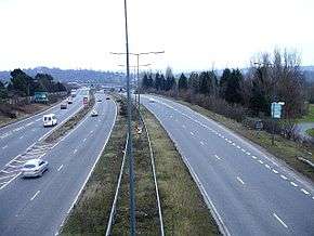
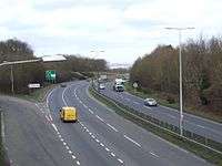
The A229 is a major road running north-south through Kent.
Route
The road begins in the Medway town of Rochester at the foot of Star Hill forming a junction with the A2 road. It then climbs up through the built-up area of Chatham, passing Troy Town and Rochester Airport before descending the slope of the North Downs at Blue Bell Hill. As it reaches the summit of the climb there is the first of two complicated series of junctions, this with the M2 motorway. Below the road as it descends is the tunnel carrying High Speed 1. Once into the Medway Valley the northern outskirts of Maidstone are reached; and a second series of junctions, this time with the M20 motorway are reached.
Six miles (10 km) from its start, the A229 traverses Maidstone through the suburbs of Sandling and Ringlestone to the north; when the road reaches the right bank of the River Medway it is joined by the A26 road from the west. The road skirts the town and begins to climb - this time up to the Greensand Ridge. Here the road leading to Tenterden (the A274) forms a left-hand junction. The summit is reached at Loose, built on the southern slope; next, also on a hillside, is Linton; at the foot of that hill the road enters the broad valley of the River Beult, one of the main tributaries of the River Medway. Nine miles (14 km) from the start, the large linear village of Staplehurst is reached, standing on its own piece of higher ground above the plain.
Soon after Staplehurst the road begins another climb - this time up to the Weald. During the climb it bypasses Cranbrook; and then follows a further climb into Hawkhurst. This village is in two parts: where the A268 makes a crossroads, and then lower down comes The Moor, the lower half of the village.
At this point the A229, prior to the 1990s, followed a route south of Hawkhurst, following the course of a Roman Road passing to the west of Bodiam and through Cripp's Corner and Sedlescombe before meeting the A21 just south of the River Brede. This section was redesignated B2244 in the 1990s.
At The Moor the A229 has now taken over the most easterly part of the A265, so that it now joins the A21 north of Hurst Green just south of the East Sussex border, at Cooper's Corner. This reduced its original length by some 5 miles (8 km).
Traffic
The A229 through Maidstone is a major bottleneck on the route, with long daily morning and evening queues entering both sides of the town.[1] Otherwise the road passes through little in the way of built-up areas. It is principally a link between the Medway Towns, Maidstone and the south coast around Hastings.
Criminals
The road has had the largest Checkpoint campaign the county has ever seen.[2]
Ghostly hitchhiker at Blue Bell Hill
On Friday 19 November 1965, a road accident with a Jaguar car at Blue Bell Hill on the A229 killed three women in a Ford Cortina APG 825B of four. One of the women, 22-year old Susan Browne from Gillingham, who was due to wed RAF technician Brian Wetton, died five days later at West Kent Hospital in Maidstone; the two other females, Judith Lingham and Patricia Ferguson, died soon after the accident. There have been at least four reports of a female hitchhiker at Bluebell Hill who then disappears from the back seat shortly after setting off, to the motorist's bewilderment. One report is of a female in a wedding dress.
Reports of a female hitchhiker began in 1968.[3][4]
References
- ↑ "Plan unveiled to end bridge traffic misery". Kent Online. 26 August 2005. Retrieved 19 January 2012.
- ↑ Criminals targeted in road check - BBC News
- ↑ Kent News hitchhiker
- ↑ BBC Southern Counties
External links
A roads in Zone 2 of the Great Britain road numbering scheme | ||
|---|---|---|
Coordinates: 51°12′08″N 0°31′00″E / 51.2023°N 0.5168°E