A1 autoroute

This article is about the French motorway. For other uses, see List of A1 roads.

A1 autoroute shield

A1 autoroute
Autoroute du Nord
Route information
Part of
Maintained by SANEF
Length: 211 km (131 mi)
Existed: 1967 – present
Major junctions
South end: Paris (Porte de la Chapelle)
 
  • <span style="padding:3px; text-align:center; color:#fff; background-color:red; font-size:80%; font-weight:bolder;" font-weight:bold;">A86 near Paris
  • <span style="padding:3px; text-align:center; color:#fff; background-color:red; font-size:80%; font-weight:bolder;" font-weight:bold;">A3 near Seine-Saint-Denis
  • <span style="padding:3px; text-align:center; color:#fff; background-color:red; font-size:80%; font-weight:bolder;" font-weight:bold;">A29 in Picardy
  • <span style="padding:3px; text-align:center; color:#fff; background-color:red; font-size:80%; font-weight:bolder;" font-weight:bold;">A2 near Combles
  • <span style="padding:3px; text-align:center; color:#fff; background-color:red; font-size:80%; font-weight:bolder;" font-weight:bold;">A26 in Pas-de-Calais
  • <span style="padding:3px; text-align:center; color:#fff; background-color:red; font-size:80%; font-weight:bolder;" font-weight:bold;">A21 near Noyelles-Godault
  • <span style="padding:3px; text-align:center; color:#fff; background-color:red; font-size:80%; font-weight:bolder;" font-weight:bold;">A22 near Aéroport de Lesquin
North end: Lille
Highway system
Autoroutes of France
The A1 near Roissy-en-France
The A1 near Péronne

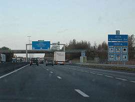
The A1 Autoroute, also known as l'autoroute du Nord (the Northern Motorway), is the busiest of France's autoroutes. With a length of 211 km (131 mi), it connects Paris with the northern city of Lille. It is managed by the Société des Autoroutes du Nord et de l'Est de la France (SANEF). The autoroute serves the northern suburbs of Paris, including the Stade de France, Le Bourget, Paris' Roissy Charles de Gaulle Airport, and Parc Astérix. From there it crosses Picardy, without directly passing through any of the major cities of the région. Throughout Picardy, the A1 runs parallel to the LGV Nord.

Around 120 km (75 mi) from Paris, between the towns of Amiens and Saint-Quentin and near the Aire de service d'Assevillers (the largest motorway plaza in Europe), the A1 crosses over the A29. A few dozen kilometers further north it forms the southern terminus of the A2, which branches off towards Brussels. The A1 is also crossed by the A26 and the A21, and it makes up part of European routes E15, E17, and E19. At its northern terminus, the A1 turns into the A25.

History

List of exits and junctions

Exit/Junction Destination
 1 Boulevard Péripherique
 2  Saint-Denis
 3  Sarcelles, Amiens via N1 and <span style="padding:3px; text-align:center; color:#fff; background-color:red; font-size:80%; font-weight:bolder;" font-weight:bold;">A16
 4  La Courneuve
 Aire de repos de La Courneuve
  <span style="padding:3px; text-align:center; color:#fff; background-color:red; font-size:80%; font-weight:bolder;" font-weight:bold;">A86, Nanterre
 5  Le Blanc-Mesnil
  <span style="padding:3px; text-align:center; color:#fff; background-color:red; font-size:80%; font-weight:bolder;" font-weight:bold;">A3, <span style="padding:3px; text-align:center; color:#fff; background-color:red; font-size:80%; font-weight:bolder;" font-weight:bold;">A104
 6  Aéroport CDG, Senlis via N17
 Aire de services de Vémars
 7  Chantilly
    Parc Astérix
 8  Senlis, Creil, Meaux
 Péage de Chamant
 9  Pont-Sainte-Maxence
 10  Compiègne, Beauvais
 11  Montdidier
 12  Amiens, Roye
  <span style="padding:3px; text-align:center; color:#fff; background-color:red; font-size:80%; font-weight:bolder;" font-weight:bold;">A29
 13  Saint-Quentin
 Aire de services d'Assevillers
 13.1  Péronne
 14  Bapaume
 Aire de services de Wancourt
 15  Arras
  <span style="padding:3px; text-align:center; color:#fff; background-color:red; font-size:80%; font-weight:bolder;" font-weight:bold;">A26
 Péage de Fresnes-lès-Montauban
 16  Douai, Arras via N50
 16.1  Hénin-Beaumont
 17  Lens
  <span style="padding:3px; text-align:center; color:#fff; background-color:red; font-size:80%; font-weight:bolder;" font-weight:bold;">A21
 17.1  Plate-forme multimodale de Dourges
 18  Carvin
 Aire de repos de Carvin
 19  Seclin
 20  Aéroport de Lille-Lesquin
  <span style="padding:3px; text-align:center; color:#fff; background-color:red; font-size:80%; font-weight:bolder;" font-weight:bold;">A27
 21  Lille

European Routes

European Route Location
 1  through  <span style="padding:3px; text-align:center; color:#fff; background-color:red; font-size:80%; font-weight:bolder;" font-weight:bold;">A2
 <span style="padding:3px; text-align:center; color:#fff; background-color:red; font-size:80%; font-weight:bolder;" font-weight:bold;">A3 <span style="padding:3px; text-align:center; color:#fff; background-color:red; font-size:80%; font-weight:bolder;" font-weight:bold;">A104 through  <span style="padding:3px; text-align:center; color:#fff; background-color:red; font-size:80%; font-weight:bolder;" font-weight:bold;">A26
 <span style="padding:3px; text-align:center; color:#fff; background-color:red; font-size:80%; font-weight:bolder;" font-weight:bold;">A26 through  21 

External links

Route map: Bing / Google

KML is from Wikidata
This article is issued from Wikipedia - version of the 10/15/2016. The text is available under the Creative Commons Attribution/Share Alike but additional terms may apply for the media files.