8th Street East, Saskatoon
8th Street East is a road serving the city of Saskatoon, Saskatchewan. It begins as a continuation of a minor residential street (8th Street West) at Highway 219 (Lorne Avenue) in Saskatoon, and runs through the city, eventually exiting the city limits, going through the eastern part of Corman Park Rural Municipality and continuing to Range Road 3033 in the Blucher Rural Municipality near Patience Lake.
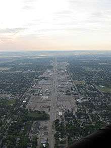
8th Street East is an important arterial road within Saskatoon, and from Clarence Avenue to McKercher Drive is considered the city's main suburban commercial district, with many shops and businesses, including a major regional shopping centre and several strip malls located on the road. Until the 1980s–early 1990s it also featured a number of motels and hotels, but these were gradually demolished in favour of retail development (as of 2016, there are only two).
8th Street East is divided by a boulevard until Boychuk Drive, where it downgrades to a two-lane road, and becomes a gravel road after leaving the developed portion of Saskatoon. After eventually leaving the city limits, it becomes part of the longer but broken-up Township Road 364.
The City of Saskatoon's long-term plan for development of annexed lands to the east show a new commercial zone planned along the eastern extension of 8th Street, similar to what now exists along much of its established route.[1] 8th Street will form the southern boundary of a new community called Brighton, plans for which were approved in the spring of 2014.
Intersections from west to east
| Municipality | km from western end | Intersecting Roads |
|---|---|---|
| Continues westward as 8th Street West | ||
| Saskatoon | 0 | Lorne Avenue (start) |
| ~0.5 | Victoria Avenue | |
| ~1 | Broadway Avenue | |
| 1.6 | Clarence Avenue South | |
| 2 | Munroe Avenue South | |
| 2.4 | Cumberland Avenue South | |
| 3 | Grosvenor Avenue | |
| 3.3 | Preston Avenue South | |
| 4 | Arlington Avenue | |
| 4.5 | Circle Drive | |
| 5 | Acadia Drive | |
| 5.7 | McKercher Drive | |
| 6 | none (adjacent Wildwood Golf Club) | |
| 6.5 | Boychuk Drive | |
| 7 | Briargate Road | |
| ~7.5 | Unnamed rural road (connects to Hillcrest Memorial Gardens and Highway 16)/rail crossing | |
| 8 | McOrmond Drive (to be replaced by yet-unnamed Brighton access road) | |
| ~8.5 | Future Brighton access road | |
| ~9 | Future McOrmond Drive realignment | |
| 10 | Haight Road (alignment to move to east in future or possibly removed) | |
| Leave Saskatoon | ||
| Corman Park RM | 11 | Winmill Road (Range Road 3043) |
| 13 | Freeborn Road (Range Road 3042) | |
| 14 | Range Road 3041 | |
| 16 | Settler's Ridge Road (Range Road 3040) | |
| Blucher RM | 17 | Range Road 3035 |
| 19 | Highway 316 | |
| 21 | Range Road 3033 (end) | |
See also
References
- ↑ "Holmwood Sector (formerly East Sector)". City of Saskatoon. Retrieved 2013-08-27.
Coordinates: 52°06′53″N 106°31′57″W / 52.1147°N 106.5326°W