63rd parallel north

63°
63rd parallel north

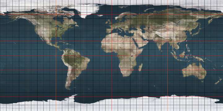
The 63rd parallel north is a circle of latitude that is 63 degrees north of the Earth's equatorial plane. It crosses the Atlantic Ocean, Europe, Asia and North America.

At this latitude the sun is visible for 20 hours, 19 minutes during the summer solstice and 4 hours, 43 minutes during the winter solstice.

Around the world

Starting at the Prime Meridian and heading eastwards, the parallel 63° north passes through:

Co-ordinates Country, territory or sea Notes
63°0′N 0°0′E / 63.000°N 0.000°E / 63.000; 0.000 (Prime Meridian) Atlantic Ocean Norwegian Sea
63°0′N 7°8′E / 63.000°N 7.133°E / 63.000; 7.133 (Norway)  Norway
63°0′N 12°12′E / 63.000°N 12.200°E / 63.000; 12.200 (Sweden)  Sweden Mainland and Ulvön Island
63°0′N 18°39′E / 63.000°N 18.650°E / 63.000; 18.650 (Baltic Sea) Baltic Sea Gulf of Bothnia
63°0′N 21°7′E / 63.000°N 21.117°E / 63.000; 21.117 (Finland)  Finland
63°0′N 31°30′E / 63.000°N 31.500°E / 63.000; 31.500 (Russia)  Russia
63°0′N 179°15′E / 63.000°N 179.250°E / 63.000; 179.250 (Bering Sea) Bering Sea
63°0′N 169°46′W / 63.000°N 169.767°W / 63.000; -169.767 (United States)  United States Alaska - St. Lawrence Island
63°0′N 169°33′W / 63.000°N 169.550°W / 63.000; -169.550 (Bering Sea) Bering Sea
63°0′N 164°43′W / 63.000°N 164.717°W / 63.000; -164.717 (United States)  United States Alaska
63°0′N 141°0′W / 63.000°N 141.000°W / 63.000; -141.000 (Canada)  Canada Yukon
Northwest Territories
Nunavut
63°0′N 90°42′W / 63.000°N 90.700°W / 63.000; -90.700 (Hudson Bay) Hudson Bay Passing just south of Southampton Island, Nunavut,  Canada
63°0′N 84°55′W / 63.000°N 84.917°W / 63.000; -84.917 (Fisher Strait) Fisher Strait
63°0′N 82°43′W / 63.000°N 82.717°W / 63.000; -82.717 (Canada)  Canada Nunavut - Bencas Island
63°0′N 82°41′W / 63.000°N 82.683°W / 63.000; -82.683 (Evans Strait) Evans Strait Passing just north of Coats Island, Nunavut,  Canada
63°0′N 81°50′W / 63.000°N 81.833°W / 63.000; -81.833 (Hudson Bay) Hudson Bay
63°0′N 78°30′W / 63.000°N 78.500°W / 63.000; -78.500 (Hudson Strait) Hudson Strait Passing just south of Nottingham Island, Nunavut,  Canada
63°0′N 71°12′W / 63.000°N 71.200°W / 63.000; -71.200 (Canada)  Canada Nunavut - Meta Incognita Peninsula, Baffin Island
63°0′N 67°28′W / 63.000°N 67.467°W / 63.000; -67.467 (Frobisher Bay) Frobisher Bay
63°0′N 66°54′W / 63.000°N 66.900°W / 63.000; -66.900 (Canada)  Canada Nunavut - Chase Island and Hall Peninsula, Baffin Island
63°0′N 64°45′W / 63.000°N 64.750°W / 63.000; -64.750 (Davis Strait) Davis Strait
63°0′N 50°30′W / 63.000°N 50.500°W / 63.000; -50.500 (Greenland)  Greenland
63°0′N 41°28′W / 63.000°N 41.467°W / 63.000; -41.467 (Atlantic Ocean) Atlantic Ocean

See also

This article is issued from Wikipedia - version of the 5/3/2016. The text is available under the Creative Commons Attribution/Share Alike but additional terms may apply for the media files.