50th parallel north

50°
50th parallel north

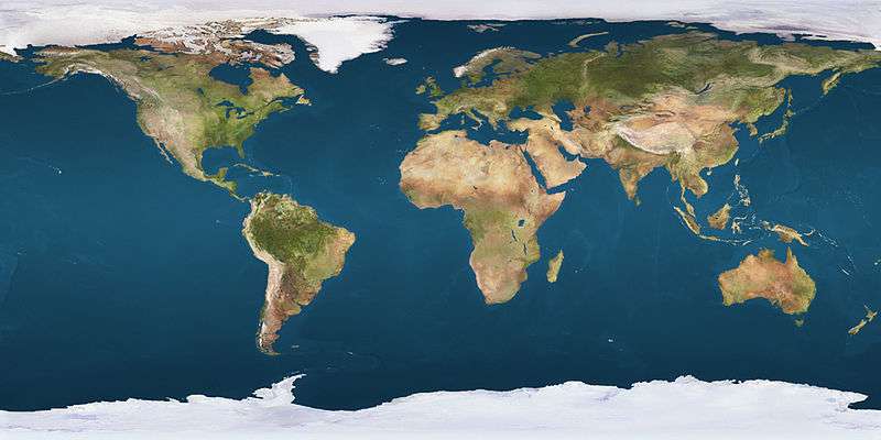
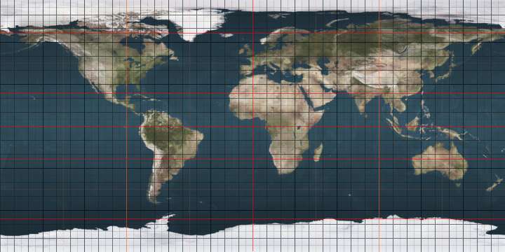
The 50th parallel north is a circle of latitude that is 50 degrees north of the Earth's equatorial plane. It crosses Europe, Asia, the Pacific Ocean, North America, and the Atlantic Ocean.

At this latitude the sun is visible for 16 hours, 22 minutes during the summer solstice and 8 hours, 4 minutes during the winter solstice.[1] The maximum altitude of the sun on the summer solstice is 63.5 degrees and on the winter solstice it is 16.5 degrees.[2]

At this latitude, the average sea surface temperature between 1982 and 2011 was about 8.5°C (47.3°F).[3]

Around the world

50th latitude mark in central Mainz, Germany
50th parallel north memorial at Kharkiv, Ukraine

Starting at the Prime Meridian and heading eastwards, the parallel 50° north passes through:

Co-ordinates Country, territory or sea Notes
50°0′N 0°0′E / 50.000°N 0.000°E / 50.000; 0.000 (Prime Meridian) English Channel
50°0′N 1°15′E / 50.000°N 1.250°E / 50.000; 1.250 (France)  France Upper Normandy — for about 20 km
Picardy — passing just north of Amiens
Nord-Pas-de-Calais — for about 13 km
50°0′N 4°10′E / 50.000°N 4.167°E / 50.000; 4.167 (Belgium)  Belgium Wallonia
50°0′N 4°40′E / 50.000°N 4.667°E / 50.000; 4.667 (France)  France Champagne-Ardenne — for about 10 km
50°0′N 4°49′E / 50.000°N 4.817°E / 50.000; 4.817 (Belgium)  Belgium Wallonia
50°0′N 5°49′E / 50.000°N 5.817°E / 50.000; 5.817 (Luxembourg)  Luxembourg Diekirch District
50°0′N 6°9′E / 50.000°N 6.150°E / 50.000; 6.150 (Germany)  Germany Rhineland-Palatinate
Hesse
Rhineland-Palatinate — passing through Mainz city centre
Hesse — passing just south of Frankfurt, crossing a runway of FRA international airport and passing just south of DCF77 time signal transmitter
Bavaria — passing just north of Bayreuth
50°0′N 12°26′E / 50.000°N 12.433°E / 50.000; 12.433 (Czech Republic)  Czech Republic Passing through southern parts of Prague
50°0′N 17°49′E / 50.000°N 17.817°E / 50.000; 17.817 (Poland)  Poland For about 11 km
50°0′N 17°58′E / 50.000°N 17.967°E / 50.000; 17.967 (Czech Republic)  Czech Republic For about 10 km
50°0′N 18°7′E / 50.000°N 18.117°E / 50.000; 18.117 (Poland)  Poland Passing through southern districts of Kraków (where crosses with 20th meridian east) and Rzeszów
50°0′N 23°10′E / 50.000°N 23.167°E / 50.000; 23.167 (Ukraine)  Ukraine Lviv Oblast — passing just north of Lviv
Ternopil Oblast — passing through Pochaiv
Khmelnytskyi Oblast
Zhytomyr Oblast — passing through Andrushivka
Kiev Oblast
Cherkasy Oblast
Poltava Oblast — passing through Lubny
Kharkiv Oblast — passing through Kharkiv city centre
50°0′N 37°57′E / 50.000°N 37.950°E / 50.000; 37.950 (Russia)  Russia Belgorod Oblast — for about 18 km
50°0′N 38°12′E / 50.000°N 38.200°E / 50.000; 38.200 (Ukraine)  Ukraine Luhansk Oblast — for about 12 km
50°0′N 38°22′E / 50.000°N 38.367°E / 50.000; 38.367 (Russia)  Russia Belgorod Oblast
Voronezh Oblast
Rostov Oblast
Volgograd Oblast
50°0′N 47°15′E / 50.000°N 47.250°E / 50.000; 47.250 (Kazakhstan)  Kazakhstan West Kazakhstan Province
50°0′N 48°8′E / 50.000°N 48.133°E / 50.000; 48.133 (Russia)  Russia Saratov Oblast
50°0′N 48°51′E / 50.000°N 48.850°E / 50.000; 48.850 (Kazakhstan)  Kazakhstan West Kazakhstan Province
Aktobe Province
Kostanay Province
Karagandy Province — passing just north of Karaganda
East Kazakhstan Province — passing just north of Oskemen
50°0′N 85°2′E / 50.000°N 85.033°E / 50.000; 85.033 (Russia)  Russia Altai Republic
Tuva
50°0′N 89°58′E / 50.000°N 89.967°E / 50.000; 89.967 (Mongolia)  Mongolia Passing through the southern tip of Uvs Lake
50°0′N 95°1′E / 50.000°N 95.017°E / 50.000; 95.017 (Russia)  Russia Tuva
50°0′N 95°45′E / 50.000°N 95.750°E / 50.000; 95.750 (Mongolia)  Mongolia For about 11 km
50°0′N 95°55′E / 50.000°N 95.917°E / 50.000; 95.917 (Russia)  Russia Tuva — for about 7 km
50°0′N 96°2′E / 50.000°N 96.033°E / 50.000; 96.033 (Mongolia)  Mongolia For about 11 km
50°0′N 96°10′E / 50.000°N 96.167°E / 50.000; 96.167 (Russia)  Russia Tuva
50°0′N 97°55′E / 50.000°N 97.917°E / 50.000; 97.917 (Mongolia)  Mongolia
50°0′N 107°13′E / 50.000°N 107.217°E / 50.000; 107.217 (Russia)  Russia Buryatia — for about 5 km
50°0′N 107°18′E / 50.000°N 107.300°E / 50.000; 107.300 (Mongolia)  Mongolia For about 3 km
50°0′N 107°20′E / 50.000°N 107.333°E / 50.000; 107.333 (Russia)  Russia Buryatia
Zabaykalsky Krai
50°0′N 113°34′E / 50.000°N 113.567°E / 50.000; 113.567 (Mongolia)  Mongolia
50°0′N 115°12′E / 50.000°N 115.200°E / 50.000; 115.200 (Russia)  Russia Zabaykalsky Krai
50°0′N 116°1′E / 50.000°N 116.017°E / 50.000; 116.017 (Mongolia)  Mongolia
50°0′N 116°20′E / 50.000°N 116.333°E / 50.000; 116.333 (Russia)  Russia Zabaykalsky Krai
50°0′N 119°6′E / 50.000°N 119.100°E / 50.000; 119.100 (China)  People's Republic of China Inner Mongolia
Heilongjiang
50°0′N 127°29′E / 50.000°N 127.483°E / 50.000; 127.483 (Russia)  Russia Amur Oblast
Khabarovsk Krai
50°0′N 140°30′E / 50.000°N 140.500°E / 50.000; 140.500 (Strait of Tartary) Strait of Tartary
50°0′N 142°9′E / 50.000°N 142.150°E / 50.000; 142.150 (Russia)  Russia Sakhalin Oblast — island of Sakhalin
50°0′N 143°59′E / 50.000°N 143.983°E / 50.000; 143.983 (Sea of Okhotsk) Sea of Okhotsk
50°0′N 155°23′E / 50.000°N 155.383°E / 50.000; 155.383 (Russia)  Russia Sakhalin Oblast — island of Paramushir
50°0′N 155°24′E / 50.000°N 155.400°E / 50.000; 155.400 (Pacific Ocean) Pacific Ocean
50°0′N 127°19′W / 50.000°N 127.317°W / 50.000; -127.317 (Canada)  Canada British ColumbiaVancouver Island (passing through the town of Campbell River) and mainland
Alberta — passing through the city of Medicine Hat
Saskatchewan
Manitoba — passing just north of Winnipeg
Ontario — passing through Lake Nipigon
Quebec
50°0′N 66°54′W / 50.000°N 66.900°W / 50.000; -66.900 (Gulf of Saint Lawrence) Gulf of Saint Lawrence Passing just north of Anticosti Island, Quebec,  Canada
50°0′N 57°45′W / 50.000°N 57.750°W / 50.000; -57.750 (Canada)  Canada Newfoundland and Labrador — island of Newfoundland
50°0′N 56°46′W / 50.000°N 56.767°W / 50.000; -56.767 (White Bay) White Bay
50°0′N 56°21′W / 50.000°N 56.350°W / 50.000; -56.350 (Canada)  Canada Newfoundland and Labrador — island of Newfoundland
50°0′N 55°52′W / 50.000°N 55.867°W / 50.000; -55.867 (Atlantic Ocean) Atlantic Ocean Confusion Bay
50°0′N 55°33′W / 50.000°N 55.550°W / 50.000; -55.550 (Canada)  Canada Newfoundland and Labrador — island of Newfoundland
50°0′N 55°31′W / 50.000°N 55.517°W / 50.000; -55.517 (Atlantic Ocean) Atlantic Ocean Passing just north of the Isles of Scilly, England,  United Kingdom
50°0′N 5°16′W / 50.000°N 5.267°W / 50.000; -5.267 (United Kingdom)  United Kingdom EnglandLizard Peninsula, Cornwall, for about 7 km
50°0′N 5°10′W / 50.000°N 5.167°W / 50.000; -5.167 (English Channel) English Channel

Sakhalin island

During the Empire of Japan era, from 1905 to 1945, the 50th parallel marked the border between the Karafuto Prefecture of Japan to the south with the Russian Empire, and later the Soviet Union, to the north in the island of Sakhalin. The entire island came under Soviet control after World War II.[4]

See also

References

This article is issued from Wikipedia - version of the 7/16/2016. The text is available under the Creative Commons Attribution/Share Alike but additional terms may apply for the media files.