2015 Moncks Corner mid-air collision
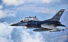 F-16, similar to the accident aircraft. | |
| Accident summary | |
|---|---|
| Date | July 7, 2015 |
| Summary | Mid-air collision due to Air Traffic Control error |
| Site | Moncks Corner, South Carolina, United States |
| First aircraft | |
| Type | General Dynamics F-16C Block 50 Fighting Falcon |
| Operator | United States Air Force |
| Registration | 96-0085 |
| Flight origin | Shaw AFB |
| Destination | Joint Base Charleston |
| Crew | 1 |
| Survivors | 1 (all) |
| Second aircraft | |
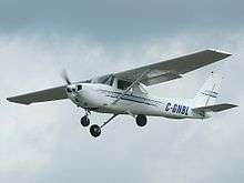 Cessna 150M, similar to the accident aircraft | |
| Type | Cessna 150M |
| Registration | N3601V |
| Flight origin | Berkeley County Airport |
| Destination | Myrtle Beach International Airport |
| Passengers | 1 |
| Crew | 1 |
| Fatalities | 2 (all) |
On July 7, 2015, a General Dynamics F-16CJ Fighting Falcon operated by the United States Air Force collided in-flight with a civilian Cessna 150M over Moncks Corner, South Carolina, United States. Both occupants of the Cessna were killed; the pilot of the F-16 ejected safely.
Accident
The F-16 was a United States Air Force General Dynamics F-16C Block 50 Fighting Falcon,[1] serial number 96-0085.[2] It was based at Shaw Air Force Base,[3] and it was operated by the 20th Fighter Wing.[4] The Cessna was a Cessna 150M,[5] registration N3601V.[6]
At about 11:00 AM on July 7, 2015, the F-16 and Cessna 150 collided over Moncks Corner, South Carolina, about 30 miles (48 km) north of Charleston.[3] Witnesses state that the Cessna was climbing when the F-16 hit it broadside.[7] The aircraft were at an altitude of 2,000 to 3,000 feet.[1] Air Traffic Control at Myrtle Beach International Airport had advised the pilot of the F-16 of the presence of the Cessna. The F-16 flew for a further three minutes before the pilot transmitted a mayday call. He then ejected safely.[8][9] Both aircraft crashed in Lewisfield Plantation.[3] Both occupants of the Cessna 150 were killed.[10] The body of the passenger has been located, but not that of the pilot/owner.[11][12] The pilot of the F-16 was on an instrument training mission. Its destination was Joint Base Charleston.[4] The Cessna was reported to be on a flight from Berkeley County Airport to Myrtle Beach.[7]
Investigation
The National Transportation Safety Board opened an investigation into the accident.[13] A preliminary report was published on July 18.[8] The cause of the accident was found to be Air Traffic Control errors in failing to provide an appropriate conflict resolution between the two aircraft.[14] The Federal Aviation Administration also opened an investigation.[7]
References
- 1 2 "F-16 collides with Cessna over South Carolina". f-16.net. Retrieved July 8, 2015.
- ↑ "Airframe Details for F-16 #96-0085". f-16.net. Retrieved July 10, 2015.
- 1 2 3 "F-16, Cessna collide over Berkeley County plantation". ABC News. Retrieved July 7, 2015.
- 1 2 Botelho, Greg; Nottingham, Shawn. "F-16 jet, Cessna airplane collide over South Carolina". CNN. Retrieved July 7, 2015.
- ↑ "Aircraft Registration (N3601V)". Flight Aware. Retrieved July 8, 2015.
- ↑ "FAA Accident and Incident Notification(s): Notice(s) Created 08-JUL-15". Federal Aviation Administration. Retrieved July 8, 2015.
- 1 2 3 Pager, Tyler. "2 killed after F-16, Cessna collide over S.C.". USA Today. Retrieved July 7, 2015.
- 1 2 "NTSB Identification: ERA15FA259A". National Transportation Safety Board. July 18, 2015. Retrieved July 19, 2015.
- ↑ "Two Dead In F-16-Cessna Collision". AVweb. Retrieved July 8, 2015.
- ↑ Santos, Suzelle; Phillips, Patrick. "NTSB: 2 killed aboard Cessna in midair collision with F-16". Tucson News Now. Retrieved July 7, 2015.
- ↑ "Cessna 150, F-16 collision: Body of passenger found as search for pilot continues". CBC News. July 8, 2015. Retrieved July 8, 2015.
- ↑ "FAA Registry – Aircraft – N-Number Inquiry". Federal Aviation Administration. Retrieved July 8, 2015.
- ↑ "Shaw Air Force Base F-16 pilot taken to Joint Base Charleston". The State. Retrieved July 7, 2015.
- ↑ "Educating Controllers on Two Midair Collisions" (PDF). National Transportation Safety Board. 14 November 2016. Retrieved 19 November 2016.
Coordinates: 33°11′46″N 80°00′36″W / 33.196°N 80.010°W