2007 Kent earthquake
 Folkestone | |
| Date | 28 April 2007 |
|---|---|
| Magnitude | 4.3 ML |
| Depth | 5.3 kilometres (3 mi) |
| Epicenter | 51°06′N 1°10′E / 51.10°N 1.17°E |
| Areas affected | Kent, England |
| Max. intensity | 6 EMS - Slightly Damaging |
| Casualties | 2 (minor injury) |
The 2007 Kent earthquake registered 4.3 on the Richter scale and struck south east Kent, South East England on 28 April 2007 at 07:18:12 UTC (08:18:12 local time), at a shallow depth of 5.3 km.[1]
The worst affected area was the town of Folkestone, although the towns of Deal, Dover and Ashford were also affected. The tremors could be felt across much of Kent and south east England, including as far as East Sussex, Essex and Suffolk,[2] as well as on the other side of the English Channel at Calais and Brussels.[3]
Location
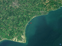
The British Geological Survey stated that the epicentre of the earthquake was less than 1 km north of Folkestone at 51.10°N, 1.17°E.[1] The United States Geological Survey indicated that the location of the earthquake was at 51.085°N, 1.009°E[4] suggesting a position approximately 5 km north west of Hythe.
Impact
The earthquake's shallow depth and proximity to Folkestone resulted in structural damage in the town, and one woman suffered a minor head and neck injury.[5] Following the earthquake, a total 474 properties were reported as damaged, with 73 properties too badly damaged for people to return to, 94 seriously damaged, and 307 suffering from minor structural damage.[6] Harvey Grammar School situated in Cheriton Road, Folkestone was closed on 30 April due to "significant structural damage".
Several thousand homes were left without power for several hours and there were reports of a "smell of gas" in Folkestone.[7] The Port of Dover, the channel tunnel and travel links were unaffected, although authorities asked people heading towards Dover to use the A2.[8]
EDF Energy had restored electricity supplies that had been cut by the earthquake by the same afternoon.[5] The Salvation Army Church in Folkestone provided refuge on 28 April for approximately 100 people whose homes had been damaged by the earthquake.[9]
On the same morning, a 300-metre (948 ft) long crack appeared in a cliff at Barton-on-Sea in Hampshire, creating fears of a landslide, although there were mixed views from authorities on whether it could be related to the earthquake.[10]
Magnitude
The British Geological Survey gave the earthquake a reading of 4.3 on the Richter scale,[1] while the USGS and the European-Mediterranean Seismological Centre estimated that the earthquake had a body wave magnitude of 4.6 and 4.7 respectively.[4][11]
It was the largest British earthquake since the 2002 Dudley earthquake[7] and the strongest in the Dover Straits since a magnitude 4.4 earthquake in 1950.[12] The strongest recorded British earthquake is the 1931 Dogger Bank earthquake, which measured 6.1 on the Richter scale.
Ten months later, the earthquake's strength was surpassed by that of the 2008 Lincolnshire earthquake, which was 5.2 in magnitude.
Less than two years later, on 3 March 2009 at 14.35 UTC, Folkestone was shaken by a smaller magnitude 3.0 quake, located in the same area.[13]
See also
- Dover Straits earthquake of 1580
- Geology of the United Kingdom
- List of earthquakes in the British Isles
References
- 1 2 3 "2007 Earthquake Bulletin" (PDF). British Geological Survey. Archived from the original (PDF) on 12 September 2008. Retrieved 26 August 2008.
- ↑ "Homes evacuated in Kent earthquake". ananova.com. Retrieved 28 April 2007.
- ↑ Nikkhah, Roya (2007-04-29). "Earthquake shakes Kent". London: Telegraph.co.uk. Retrieved 2010-04-22.
- 1 2 "Significant earthquakes of the world 2007". United States Geological Survey. Archived from the original on 4 October 2008. Retrieved 26 August 2008.
- 1 2 "Homes evacuated in Kent earthquake". London: Guardian Unlimited. 2007-04-28. Retrieved 2007-04-28.
- ↑ "Hundreds of quake homes damaged". BBC News. 29 April 2007. Archived from the original on 10 May 2007. Retrieved 2007-04-29.
- 1 2 "Earthquake shakes parts of Kent". BBC News. 2007-04-28. Archived from the original on 2 May 2007. Retrieved 2007-04-28.
- ↑ "People felt tremors in the weeks leading up to Earthquake". KentNews.co.uk. 2007-04-28. Archived from the original on 31 May 2007. Retrieved 2007-06-03.
- ↑ "Salvation Army Brings Comfort to Kent Earthquake Victims". Christian Today. Archived from the original on 3 May 2007. Retrieved 1 May 2007.
- ↑ "Landslip fear over clifftop crack". BBC News. 2007-04-28. Retrieved 2007-04-28.
- ↑ "Mb 4.7 South-East of UK on 28/04/2007 07:18 UTC". European-Mediterranean Seismological Centre. Retrieved 29 April 2007.
- ↑ "Folkestone Earthquake Press Release". British Geological Survey. Retrieved 11 June 2007.
- ↑ "Recent Earthquakes Reported by BGS http://www.earthquakes.bgs.ac.uk/recent_events/20090303143556.7.html
External links
| Wikinews has related news: Earthquake strikes Kent, England |
Coordinates: 51°06′N 1°10′E / 51.10°N 1.17°E