1877 Iquique earthquake
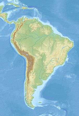 Iquique Santiago | |
| Date | May 9, 1877 |
|---|---|
| Magnitude | 8.5 MS, 9 M? |
| Epicenter | 19°36′S 70°12′W / 19.6°S 70.2°WCoordinates: 19°36′S 70°12′W / 19.6°S 70.2°W |
| Areas affected | Peru, Tarapacá Region and Bolivia, Antofagasta Region (both now part of Chile) |
| Tsunami | Yes |
| Casualties | 2,541 |
The 1877 Iquique earthquake occurred at 21:16 local time on 9 May (0:59 on 10 May UTC). It had a magnitude of 8.5 on the surface wave magnitude scale.[1] Other estimates of its magnitude have been as high as 9.0.[2] It had a maximum intensity of XI (Extreme) on the Mercalli intensity scale[3] and triggered a devastating tsunami. A total of 2,541 people died, mainly in Peru and what is now northernmost Chile, with some deaths also reported from Hawaii and Japan.
Historical context
Affected areas in what is now the Antofagasta region of Chile had during this period been subject to the Atacama border dispute between Bolivia and Chile. Under the 1874 boundary treaty between Bolivia and Chile, the border between the two nations as of 1877 followed the 24th parallel south. The terms of that treaty required that Bolivia not levy taxes on Chilean companies mining nitrates between the 23rd and 24th parallels (including the city of Antofagasta) for 25 years, except for agreed duties to be shared between the two countries.[4]
Following extensive damage in the 1877 earthquake and tsunami, the municipal authorities in Antofagasta voted for a tax of 10 centavos per quintal (approximately 46 kg or 101 lb) of nitrates exported to fund reconstruction of the town.[5] The Chilean Antofagasta Nitrate & Railway Company, a major nitrate mining company in the region, refused to pay, backed by the Chilean government. This dispute resulted in the War of the Pacific, fought from 1879–84,[5] by which Chile gained control of territory as far north as Tacna, including Bolivia's entire coastline.
Tectonic setting
Coastal regions of Peru and Chile lie above the convergent boundary, where the Nazca Plate is being subducted beneath the South American Plate along the line of the Peru–Chile Trench. The rate of convergence across this boundary is measured at about 8 cm (3.1 in) per year. This boundary has been the site of many great megathrust earthquakes, in addition to events caused by faulting within both the subducting and over-riding plates.[2]
Damage
The earthquake shaking caused significant damage over most of the coastal parts of the Tarapacá and Antofagasta Regions. The tsunami caused a 10 m (33 ft) wave along about 500 km (310 mi) of coast, from Arica in the north to Mejillones in the south.[6] At Arica the water reached the cathedral. The hulk of the U.S. gunboat Wateree, which had been beached hundreds of metres inland by the final wave of the tsunami triggered by the 1868 Arica earthquake, was moved several kilometres to the north along the coast and nearer the shoreline.[7] The tsunami caused 5 deaths in Hilo, Hawaii, where 37 houses were destroyed. In Japan, on the Boso Peninsula, many deaths were recorded.[8]
Characteristics
Earthquake
The shaking lasted for five minutes at Caleta Pabellón de Pica, a coastal town 70 km (43 mi) south of Iquique. The area of felt intensity of VIII on the Mercalli intensity scale or greater, extended from about 50 km (31 mi) south of Arica to just south of Cobija. This indicates a rupture length of about 420 km (260 mi).[9]
Tsunami
The tsunami affected the coasts of Peru and northern Chile and was observed across the Pacific Ocean, in Australia, New Zealand, Samoa, Tonga, Fiji, Hawaii, Mexico, California and Japan.[8][10] At Arica eight separate large waves were recorded.[11]
Future earthquake hazard
The rupture area of the 1877 earthquake has been recognised as one of the major seismic gaps on the plate boundary, known as the "Northern Chile Seismic Gap". The Mw = 7.7 2007 Tocopilla earthquake occurred at the southern edge of the gap, but is not considered to have necessarily reduced the risk of a great megathrust earthquake within this area.[2] In 2005, a recurrence period of 135 years was estimated for great earthquakes along this part of the plate boundary, suggesting that a similar earthquake to the 1877 event was likely in the early 21st century.[12] The 2014 Iquique earthquake struck in the same seismic gap with a magnitude of Mw = 8.2.
See also
- 1868 Arica earthquake
- List of earthquakes in Chile
- List of historical earthquakes
- List of historical tsunamis
References
- ↑ (Spanish) Servicio sismológico Universidad de Chile, Sismos importantes o destructivos desde 1570.
- 1 2 3 Delouis, B.; Pardo M., Legrand D. & Monfret T. (2009). "The Mw 7.7 Tocopilla Earthquake of 14 November 2007 at the Southern Edge of the Northern Chile Seismic Gap: Rupture in the Deep Part of the Coupled Plate Interface" (PDF). Bulletin of the Seismological Society of America. 99 (1): 87–94. Bibcode:2009BuSSA..99...87D. doi:10.1785/0120080192.
- ↑ NGDC. "Comments for the Significant Earthquake". Retrieved 1 January 2011.
- ↑ The Ten Cents War: Chile, Peru, and Bolivia in the War of the Pacific, 1879-1884, page 39, Bruce W. Farcau, 2000. Accessed 17 July 2011
- 1 2 The Ten Cents War: Chile, Peru, and Bolivia in the War of the Pacific, 1879-1884, page 40, Bruce W. Farcau, 2000. Accessed 17 July 2011
- ↑ Hatori, T. (1968). "Study on distant tsunamis along the Coast of Japan. Part 2, tsunamis of South American origin" (PDF). Bulletin of the Earthquake Research Institute. 46: 345–359. Retrieved 2 January 2011.
- ↑ Kovach, R.L. (2004). Early earthquakes of the Americas. Cambridge University Press. p. 138. ISBN 978-0-521-82489-7.
- 1 2 NGDC. "Tsunami Runups". Retrieved 31 December 2010.
- ↑ Comte, D.; Pardo M. (1991). "Reappraisal of Great Historical Earthquakes in the Northern Chile and Southern Peru Seismic Gaps" (PDF). Natural Hazards. 4: 23–44. doi:10.1007/bf00126557. Retrieved 2 January 2011.
- ↑ An oceanic perturbation, Otago Daily Times , Issue 4753, 12 May 1877, Page 2
- ↑ NGDC. "Comments for the Tsunami Runup - Arica". Retrieved 2 January 2011.
- ↑ Zamudio, Y.; Berrocal J. & Fernandes C. (2005). "Seismic hazard assessment in the Peru-Chile border region" (PDF). 6th International Symposium on Andean Geodynamics (ISAG 2005, Barcelona), Extended Abstracts. pp. 813–816. Retrieved 2 January 2011.