Ōmachi, Nagano
| Ōmachi 大町市 | ||
|---|---|---|
| City | ||
| ||
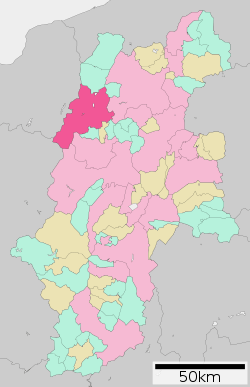 Location of Ōmachi in Nagano Prefecture | ||
 Ōmachi Location in Japan | ||
| Coordinates: 36°30′N 137°51′E / 36.500°N 137.850°ECoordinates: 36°30′N 137°51′E / 36.500°N 137.850°E | ||
| Country | Japan | |
| Region | Chūbu (Kōshin'etsu) | |
| Prefecture | Nagano Prefecture | |
| Government | ||
| • Mayor | Tōru Ushikoshi | |
| Area | ||
| • Total | 564.99 km2 (218.14 sq mi) | |
| Population (July 2014) | ||
| • Total | 29,397 | |
| • Density | 52/km2 (130/sq mi) | |
| Symbols | ||
| • Tree | Ōyamazakura | |
| • Flower | Katakuri | |
| • Bird | Ptarmigan | |
| • Others | Animal: Japanese Serow | |
| Time zone | Japan Standard Time (UTC+9) | |
| City hall address |
3887, Ōmachi, Ōmachi-shi, Nagano-ken 398-0002 | |
| Website |
www | |

Ōmachi (大町市 Ōmachi-shi) is a city located in Nagano Prefecture, Japan.
As of 2014, the city has an estimated population of 29,397 and a population density of 52 persons per km². The total area is 564.99 km².
The city was founded on July 1, 1954. Ōmachi City is located north of Matsumoto City, also located in Nagano Prefecture.
The National Treasure Nishina Shinmei Shrine is located in Ōmachi. Lake Kizaki is also situated near Ōmachi City.
Geography
Vast Northern Japanese Alps (or Hida Mountains) of above sea level 3000m ranges to the west of the city. Mountains 1000m near range to the east part.
The Takase River runs through the Matsumoto basin placed between the mountain to the north south.
Three lakes that are called Nishina three lakes (仁科三湖 Nishina-san-ko) range to the south north in the northern part of the city. Then, it is thought that the Itoigawa-Shizuoka Tectonic Line (ISTL) (糸魚川静岡構造線 Itoigawa Shizuoka Kōzō Sen) active fault system is running.
It is the only city in the Daihoku District (大北地域 Daihoku-chiiki), and the urban function of the politics and economics has accumulated.
- Mountains: Mount Yari (槍ヶ岳 Yari-ga-take), Mount Noguchigorō (野口五郎岳 Noguchigorō-dake), Mount Eboshi (烏帽子岳 Eboshi-dake), Mount Sugoroku (双六岳 Sugoroku-dake),Mount Otenshō (大天井岳 Otenshō-dake), Mount Tsubakuro (燕岳 Tsubakuro-dake), Mount Gaki (餓鬼岳 Gaki-dake), Mount Harinoki (針ノ木岳 Harinoki-dake), Mount Renge (蓮華岳 Renge-dake),Mount Jii (爺ヶ岳 Jii-ga-take), Mount Kashimayari (鹿島槍ヶ岳 Kashimayari-ga-take), Mount Goryū (五竜岳 Goryū-dake),
- Rivers: Takase River (Nagano)
- Lakes and marshes: Nishina three lakes (仁科三湖 Nishina-san-ko) ( Lake Kizaki (木崎湖 Kizaki-ko), Lake Nakatsuna (中綱湖 Nakatsuna-ko), Lake Aoki (青木湖 Aoki-ko) )
Climate
Due to its elevation, Omachi lies at the junction of three different climate types, namely the humid continental climate (Köppen Dfa/Dfb), humid subtropical climate (Köppen Cfa) and, uniquely for Japan, the subtropical highland climate (Köppen Cfb). Winters are cold and very snowy, while summers are very warm and wet.
| Climate data for Omachi, Nagano (1981–2010) | |||||||||||||
|---|---|---|---|---|---|---|---|---|---|---|---|---|---|
| Month | Jan | Feb | Mar | Apr | May | Jun | Jul | Aug | Sep | Oct | Nov | Dec | Year |
| Average high °C (°F) | 1.4 (34.5) |
2.3 (36.1) |
6.7 (44.1) |
14.9 (58.8) |
20.3 (68.5) |
23.3 (73.9) |
26.6 (79.9) |
28.2 (82.8) |
23.2 (73.8) |
17.3 (63.1) |
11.3 (52.3) |
4.9 (40.8) |
15.1 (59.2) |
| Daily mean °C (°F) | −2.9 (26.8) |
−2.5 (27.5) |
1.1 (34) |
8.0 (46.4) |
13.6 (56.5) |
17.6 (63.7) |
21.1 (70) |
22.2 (72) |
17.9 (64.2) |
11.3 (52.3) |
5.4 (41.7) |
0.1 (32.2) |
9.4 (48.9) |
| Average low °C (°F) | −7.6 (18.3) |
−7.5 (18.5) |
−3.9 (25) |
1.9 (35.4) |
7.8 (46) |
12.9 (55.2) |
17.0 (62.6) |
17.8 (64) |
13.7 (56.7) |
6.6 (43.9) |
0.6 (33.1) |
−4.3 (24.3) |
4.6 (40.3) |
| Average precipitation mm (inches) | 80.3 (3.161) |
81.6 (3.213) |
98.5 (3.878) |
95.3 (3.752) |
121.2 (4.772) |
165.5 (6.516) |
195.8 (7.709) |
134.2 (5.283) |
168.4 (6.63) |
109.8 (4.323) |
76.4 (3.008) |
70.3 (2.768) |
1,397.1 (55.004) |
| Average snowfall cm (inches) | 180 (70.9) |
147 (57.9) |
91 (35.8) |
8 (3.1) |
0 (0) |
0 (0) |
0 (0) |
0 (0) |
0 (0) |
1 (0.4) |
9 (3.5) |
89 (35) |
525 (206.6) |
| Source: Japan Meteorological Agency[1] | |||||||||||||
History
On January 1, 2006, the villages of Miasa and Yasaka (both from Kitaazumi District) were merged into Ōmachi.
References
- ↑ "平年値(年・月ごとの値)". Japan Meteorological Agency.
External links
| Wikimedia Commons has media related to Ōmachi, Nagano. |
- Ōmachi City official website (Japanese)
- Ōmachi, Nagano official guide (Japanese)